You’re hearing it here first! IL-2 Sturmovik: Great Battles is getting a new map developed by a third party team and I had the pleasure of talking with them quite a bit over recent weeks to learn all about the project. The map is being called the “Karelia map” and in this reveal I do a Q&A with elements of the team as well as show off some of the visuals, reference materials, and even a video of the map in action. Let’s go!
Updated: December 9, 2023 at 7:39 am EST with a small correction on the map scope.
What is the Karelia map project?

Years ago I was contacted by members of a third party team of enthusiasts that were working with IL-2 Sturmovik: Great Battles map tools to develop a Finnish Gulf based map for the series. This primarily Finnish-based team, weren’t ready or able to say anything about the project in the early days, however, the project is now moving into a new phase and they are ready to tell everyone about their efforts.
Now titled the Karelia map, the third party team has progressed to the point where they are ready to talk about the project, show it off, and talk about the road to release. The team have called themselves ‘KarttaKomppania’ and you can read the full Q&A below.
Q&A with KarttaKomppania
Let’s do some introductions first. Introduce yourselves and tell us a bit about how you became interested in this project either as a group or individually.
Kanttori: I’m an old Aces High and IL-2 Sturmovik 1946 player and also the founder of this project. In the summer of 2016, we were at the Mosquito Meeting of the Finnish Virtual Pilots Association in Ilomantsi, North Karelia, and we were excited about which front area Jason Williams would announce as the next part of the Battle of Stalingrad (BOS) game series.
Our expectations were that the next part after the Battle of Stalingrad and the Battle of Moscow to be one of the biggest fronts of Operation Barbarossa, i.e. the Siege of Leningrad. Unfortunately Jason announced that the next one would be the Battle of Kuban and we were quite disappointed. Then I told the present that if the gaming house wont make an important front to us Finns, then we will make the map ourselves.
Shortly after that, several of my squadron mates from different Finnish virtual Flight Squadrons signed up to join the map team, and some of them are still involved.
Already in 2006-2012 I had made with my Finnish friends the first historical Karelia terrain for the American game Aces High II and then planned the same for the old IL-2 Sturmovik 1946 sim. I even built a large 512 km x 384 km Karelia testing map base for it as well. We flew a multiplayer test flights on a still unfinished map already in 2015.
Then I switched to the BoS and immediately realised that the Karelian project must be built in the most sophisticated game engine in terms of map technology of flight simulators, which was then IL-2 Sturmovik Battle of Stalingrad.
Mats: I joined the team back in the fairly early stages of the project to help out with GIS data. Now I do a bit of everything, mostly 3d modelling and management. Our team size is currently 16 people, and that number has varied up and down over the years. We have six people working purely on 3d/2d art, five people working only on map data (converting data from old maps into game usable formats) as well as one guy working on the roads- and rail network and a researcher that can help us with archive material. In addition to these hard working people we have three of us who do the management and admin tasks. Most of our team is made up of old-school sim flyers from the Finnish Virtual Pilots community.
How long has the team been working on this project?
Kanttori: Because I am from North Karelia and my father’s family roots are in Eastern Karelia, Finnish military history was a common hobby for us all my life. Actually, I have been planning this project since the beginning of the 2000s, when I got to know Multiplayer flight simulators for the first time. That’s when I realised that in addition to the air war game, you can do a history project at the same time, i.e. the so-called Virtual Karelia. The game engine of Great Battles was good enough to build Karelia properly now. The game also has a great Mission Editor Tool with which maps are made in addition to Photoshop.
Karelia’s map team started working already in 2017, when I figured out the BOS map technology, but we still didn’t have proper data for the implementation of the map. I got the first elevation map of the current area from a French enthusiast and with it we did tests when I tried to import the very simple black and white bitmaps into the Mission Editor. At this point, many had already lost faith in me and the implementation possibilities of the entire map.
What is the scope of the map (i.e. how big is it?) and what time periods can it represent?
Kanttori: Actually, I would like this to be a real IL-2 Sturmovik game part called Siege of Leningrad and also Battle of Karelia. Our map covers all the relevant fronts of this region, from the Winter War to Operation Barbarossa, the Siege of Leningrad and finally the battles of the Karelian Isthmus and Narva. The time scale is really wide from November 1939 to September 1944 and all of them fit on our map. This is the only missing area of the WWII Eastern Front that has never been published to this extent in any flight simulator.
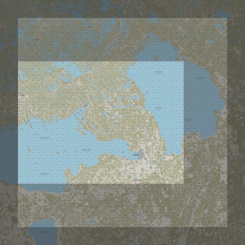
After about three years, when we have expanded to all the borders of the flight areas limits, i.e. we have made an approximately 350 km x 350 km flyable area, that area starts 16 km west of the city of Kotka and ends on the east coast of Lake Ladoga. Map also covers a small part of the northeastern corner of Estonia near Lake Peipus and Narva. The northern border goes 15km north of the city of Savonlinna, so at some point we will get to model famous and beautiful Olavinlinna castle as well.
How long has the team been working on this project?
Kanttori: I started planning the flight area of the map already in fall 2016, when French Laurent Cunin contacted me and made us the first height map from our current map. Thank you so much Laurent, you got us started! Then I contacted Jason Williams in November 2017 and I may have bombarded him with too much enthusiasm, but he finally gave us the mapping tools as a Christmas present in December as a 2018 and therefore believed in us. Thank you so much to Jason, here we are now.
I’ve seen some of the work behind the scenes and one of the things that the team has done is ensured that there are a lot of points of interest. That includes some well known landmarks. How many unique points of interest are planned and do you have some favourites that really stand out?
Kanttori: I have Karelian family roots and I have lived in both South and North Karelia all my life, and that’s why this region and the past wars are so important to me.
Lappeenranta is the Karelian city of my childhood and youth, and I know its landscapes inside out, as well as the whole of South Karelia. Lake Saimaa with thousands of islands is part of the most beautiful Finland. The ice age has made this area, also the Karelian Isthmus and the coast of the northern parts of Lake Ladoga, a unique landscape that cannot be found anywhere else in the world.
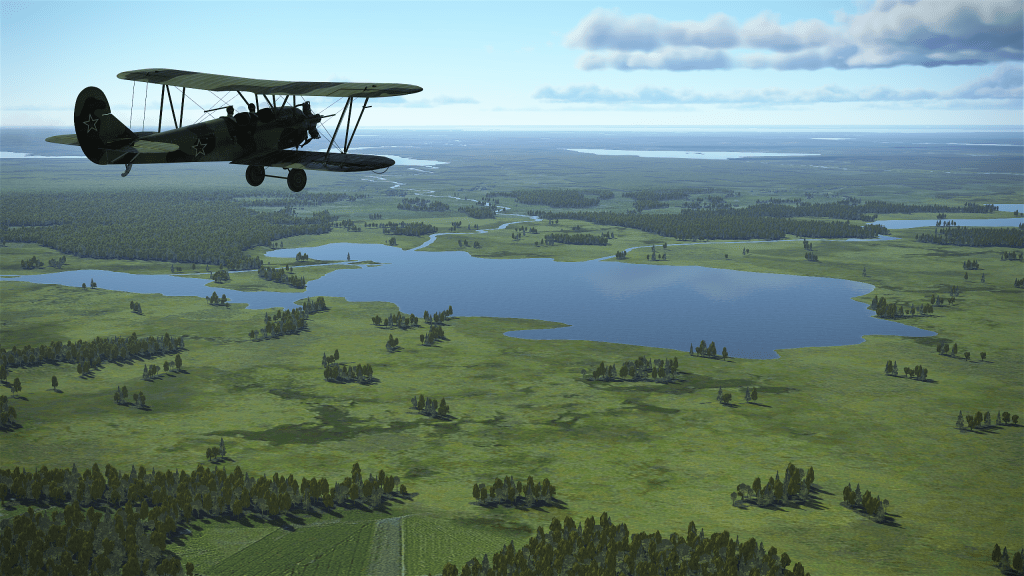
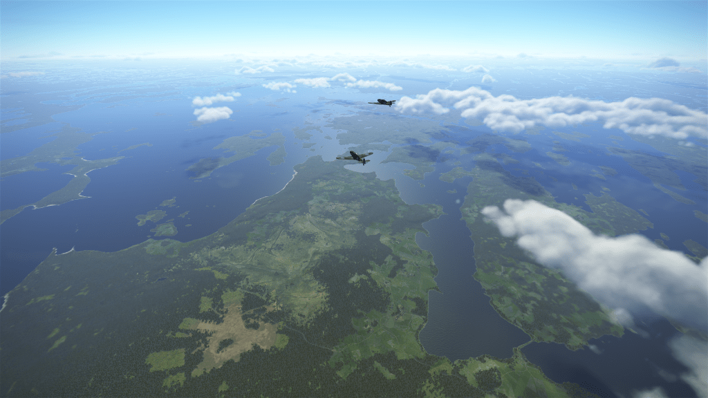
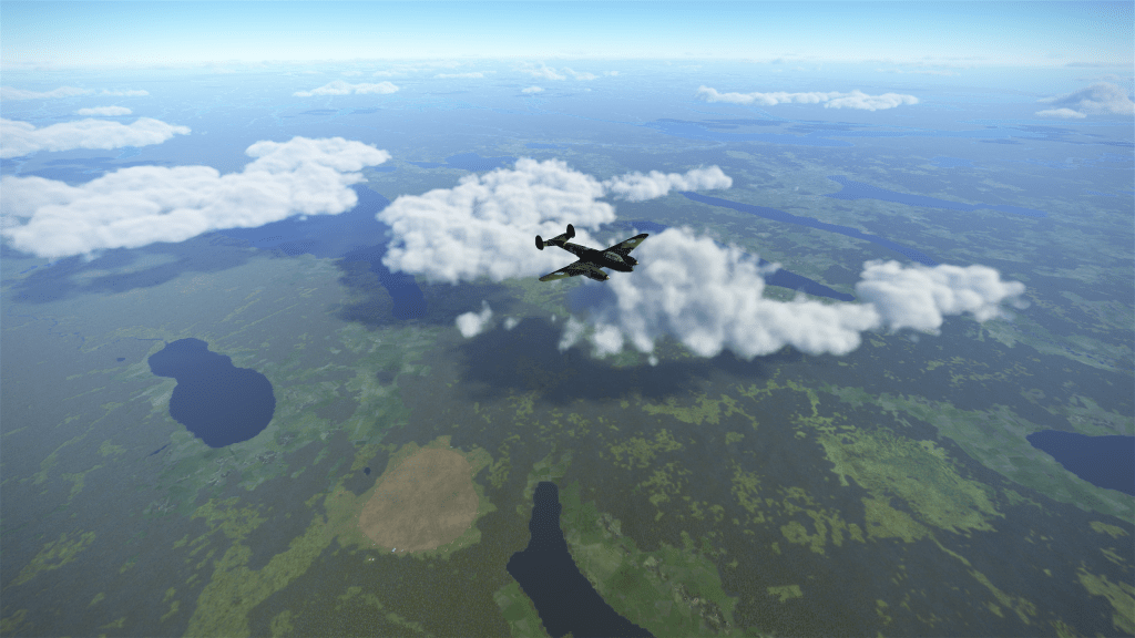
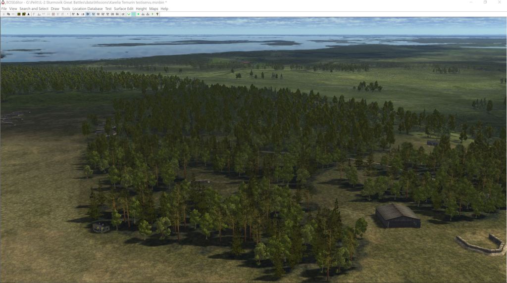
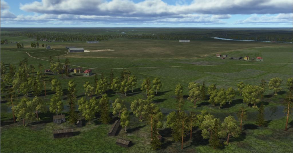
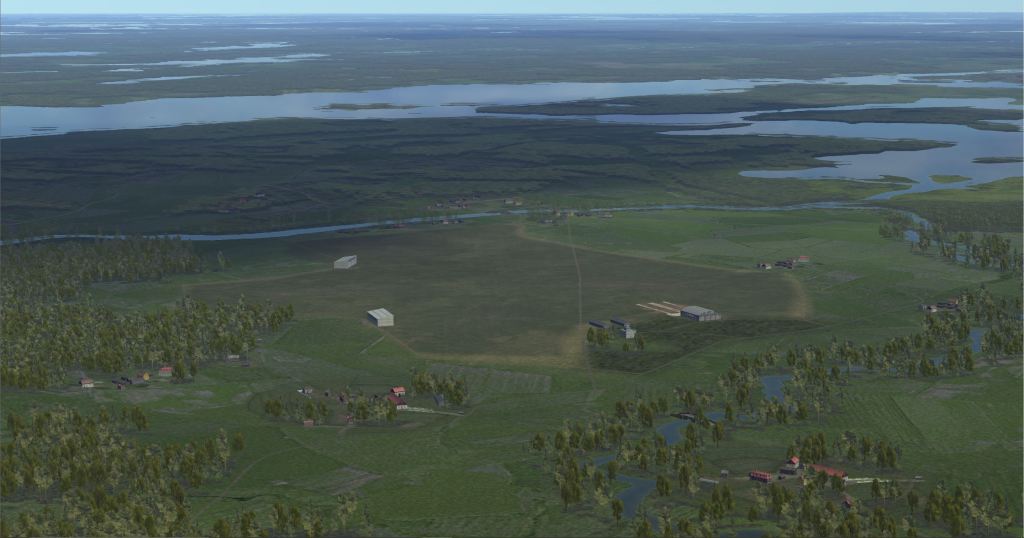
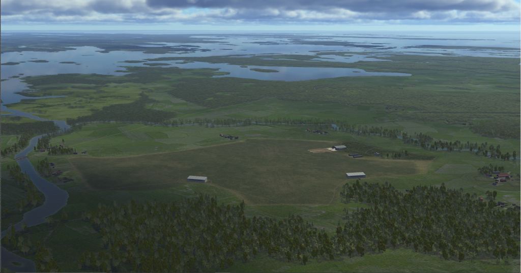
Mats: Most will know Finland as the land of the thousand lakes, and indeed you will find a lot of water on our map: The Gulf of Finland is perhaps the main water body, followed by Lake Ladoga to the east which is absolutely huge. The centre of the map is where you will find the Karelian Isthmus, the scene of the heaviest fighting in the Finnish Winter War and Continuation War. The nature on land is dense but varied forests, with comparatively small clearings for villages and fields. All the land coverage has been painstakingly recreated from war-time field maps and aerial photos to ensure that it is accurate. The map team deserves great credit for the hundreds of hours of comparatively boring editing of old maps, but the painstaking labour they put into the map really shows in the varied land cover.
As for land-marks the main ones will probably be the cities of Vyborg or Viipuri and Leningrad. Both cities will be quite unique and easily found from the air. We have tried to model as many important landmarks as we could and will continue to add them, but the list of important landmark buildings seems never ending at times.
Can you tell us a bit about the behind the scenes process that you used to develop historically accurate scenery and locations? Were photographs and charts used?
Kanttori: Enthusiasts of Finnish military history, I have collected thousands of photographs, maps, aerial photographs and plans of airfields, town plans and drawings of buildings from the Winter and Continuation War. I have also received many rare construction drawings from the Finnish Air Force Museum, e.g. aircraft dugouts, Finnish type buildings at airports, etc.
The internationally known Finnish air war historian Carl F. Geust has also been a great help and made his unique archive available to me. A few of my friends and I have shared documents between us and I can say that we have a really huge amount of digitally archived source material, at least a couple of terabits in total. A large part has yet to be arranged, but that work will be done after the map is published next spring 2024. Now we won’t have time to do it.
How much of a challenge is it to make a map project like this? Can you guess how many hours were spent over the years to make this happen?
Kanttori: We don’t even dare to count our working hours and they have never been recorded. I think from my point of view that I have been doing this now, excluding the planning phase, for almost five years. Since then, we have had about three months of summer vacation, because the summer in Finland is beautiful but short. Nine months of work from autumn to spring and I have it non-stop like a workaholic. Not 24/7, but on average 12/7, i.e. I somehow work on things related to the map for 12 hours every day. It might also include reading pilots’ memoirs or the history of the Finnish Air Force part of the time, because everything I do nowadays is somehow related to making the map of Karelia. About 270 working days a year and 12-hour working days for five years. I calculated that about 16,000 working hours, or 2,000 working days.
Which seasons are planned for the map?
Kanttori: All four seasons. We have completed summer and autumn, and winter is being worked on as we speak.
What is left for the team to do on the project before it can be released?
Kanttori: At this point, at the beginning of December 2023, we are already in the official beta test of the gaming house. In the middle of the large 409.6 km x 409.6 km map, we have delineated the most important fronts for us Finns, which are the Karelian Isthmus and the sea front of the Gulf of Finland.
The villages of Karelian Isthmus have already been populated (taken to the map) and we are now building new airports at the rate of about two airports per day. If only we can get town building blogs imported into the Mission editor and into the game, then the first map part to be published will be completed next March 2024 and will be given free of charge to all IL-2 Sturmovik game lovers.
How will this map be released to us? Will this be considered a separate DLC or how will it work?
Kanttori: Its free to all as I wrote. But if somebody wants to support us for the next two years or so, we will expand the entire map to use the 409.6 km x 409.6 km area and we will make the rest of the missing cities and airports as well. That’s why we have set up a Patreon page through which everyone can donate money to us for our work.
Support the team with their Patreon page here.
What kind of fronts and eras of battles will be possible when you’re done?
Kanttori: The time scale in the area of this map is one of the longest it was during WWII: We can make missions from our Winter War 1939-1940 to the Continuation War 1941-1944. These wars or “Forgotten Battles” may be unknown to many, but we also have the Leningrad front where the German Northern Army Corps attacked in the summer of 1941 when Operation Barbarossa began.
That was the start of the 900-day siege of Leningrad, which basically lasted until January 1944, when the Red Army beat the Germans behind the Luga River, that’s on our map too.
We also model in the future the Estonian city of Narva, so the missions about the Battle of Narva in the summer of 1944 fit well on our map. I’ve always asked, what other 410 km x 410 km map allows for such versatile tasks on a five-year time scale and between the major battles of the military forces of three states?
Hypothetically, if the series were to add aircraft to support this map. What would you like to see?
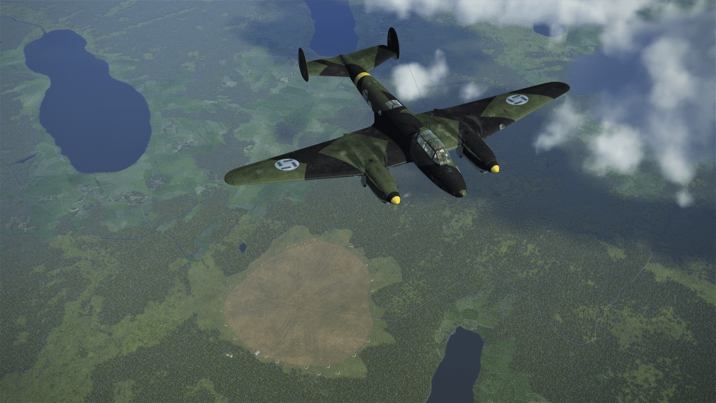
Kanttori: We could bring all the missing aircraft of the Eastern Front, such as the Polikarpov I-153 Chaika, Brewster Model 239, Curtiss Hawk 75A, Fiat G.50, Morane Saulnier M.S.406 and Fokker D.XXI fighters as well as the Ilyushin DB-3F/IL-4, Dornier Do17Z and Blenheim I-IV bombers into the game. All these planes could also be used on the maps of other game parts, with the exception of our unique Pearl of the Sky Brewster, which was only used by the Finnish Air Force in Karelian fronts during WWII.
Tell us a bit about the names on the map. Many names have changed quite a bit during the 20th Century. How have you approached this?
Kanttori: I actually wanted this to be a real IL-2 Sturmovik part called Siege of Leningrad or rather Battle of Karelia at one time, as did apparently Jason. Now, it’s the same because we can do missions for all these different fronts on the same map. The majority of the area of the map is Karelia and the old residential areas of our Finnish brother nations in Estonia and Inkeri, so we decided to put a Finnish name on the map as well.
That is why the historical place names on the Karelian Isthmus and south of the Gulf of Finland in the Leningrad Oblast area are primarily Finnish, Ingrian or Estonian, and then only in Russian.
For example, the place names of the Karelian Isthmus, which currently belongs to Russia, are nowadays in Russian and usually completely disconnected from their original Finnish names or meanings. Completely invented place names in Russian were only introduced long after the war, in 1948, as I recall.
Where does the team go from here? Do you have a sense of how long this project will take or is it a “done when it’s done” kind of project?
Kanttori: We will be expanding the flyable area of the map in a few big updates and improving the existing landscape to the end, as well as replenishing the building base, especially in Leningrad! Local 3D modellers would really be needed for the construction site to make St. Petersburg’s wonderful landmark buildings. so you can register to work for us by contacting me or the game house developers.
We cannot pay anything for the building models at this stage, because we have been doing this ourselves for a long time without any compensation. But now everyone has a unique opportunity to have their building models and also names visible on the newest, biggest and perhaps also the most beautiful map of the IL-2 Sturmovik Great Battles game series. But the beauty of the map is actually up to the player community. We at KarttaKompania always do our best for our Karelia Map, which is so important to us!
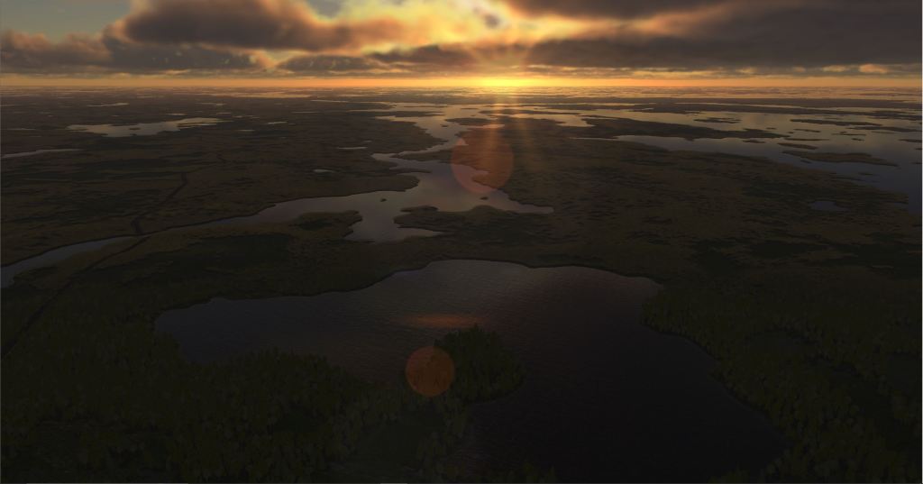
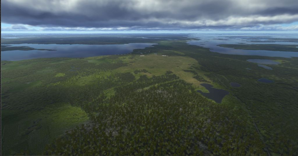
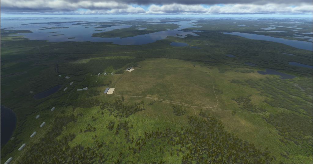
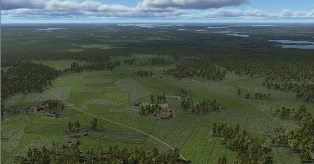
A look at the map and more
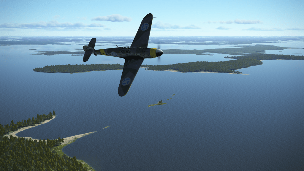
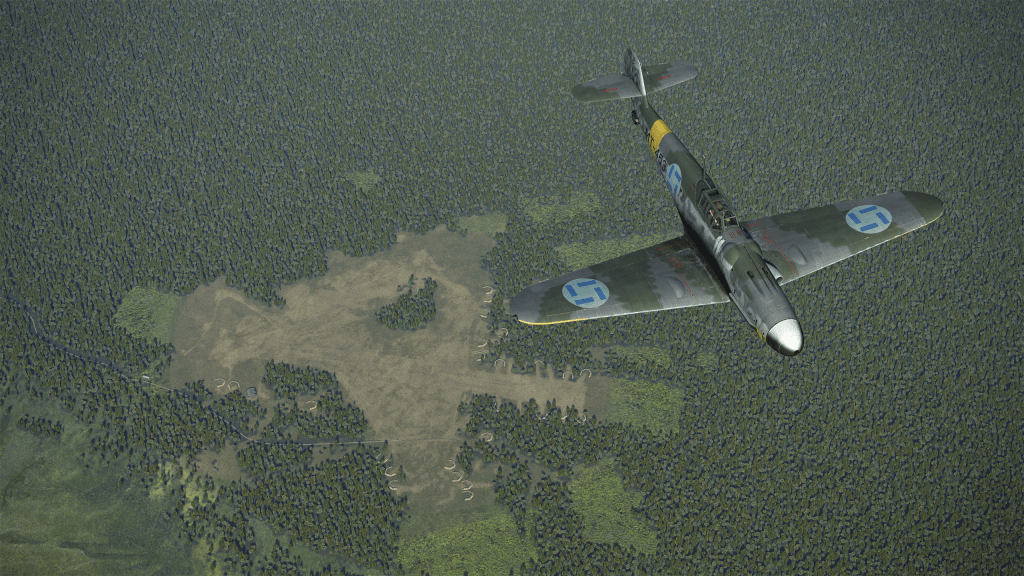
Some of the media that the team sent me included a mix of polished screenshots as well as some more work in progress items that give you a sense of what effort is being put into recreating some of the airbases and landmarks.
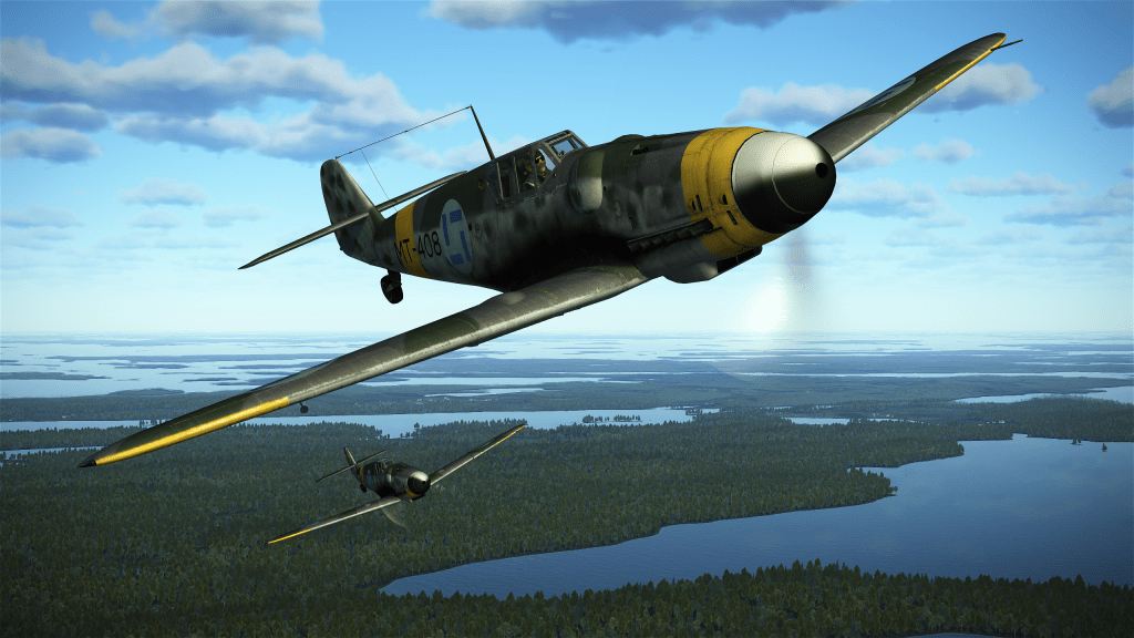
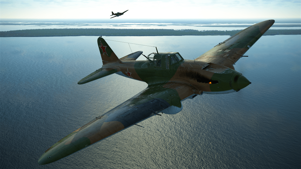
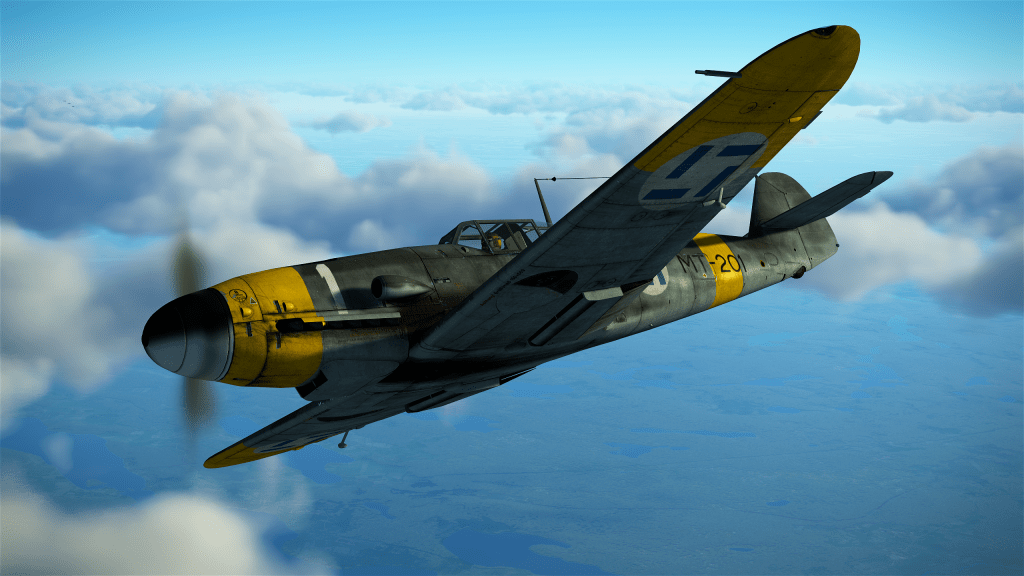
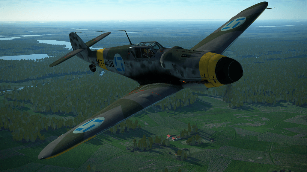
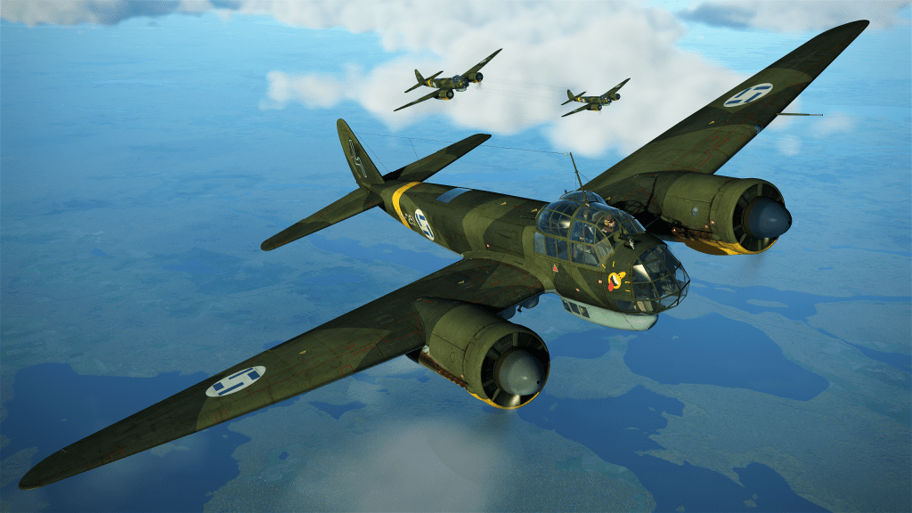
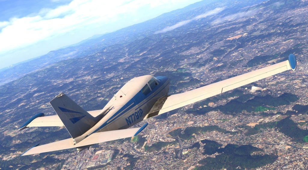
First we have this batch of aircraft screenshots that show off the map together with some Finnish aircraft.


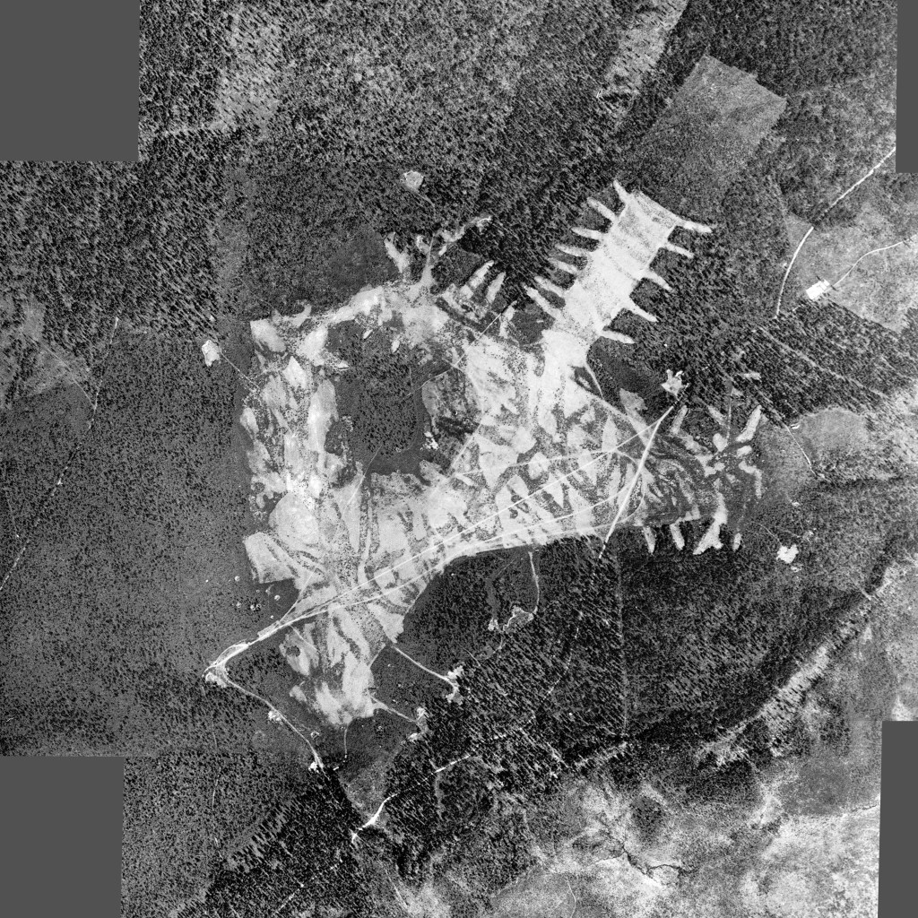
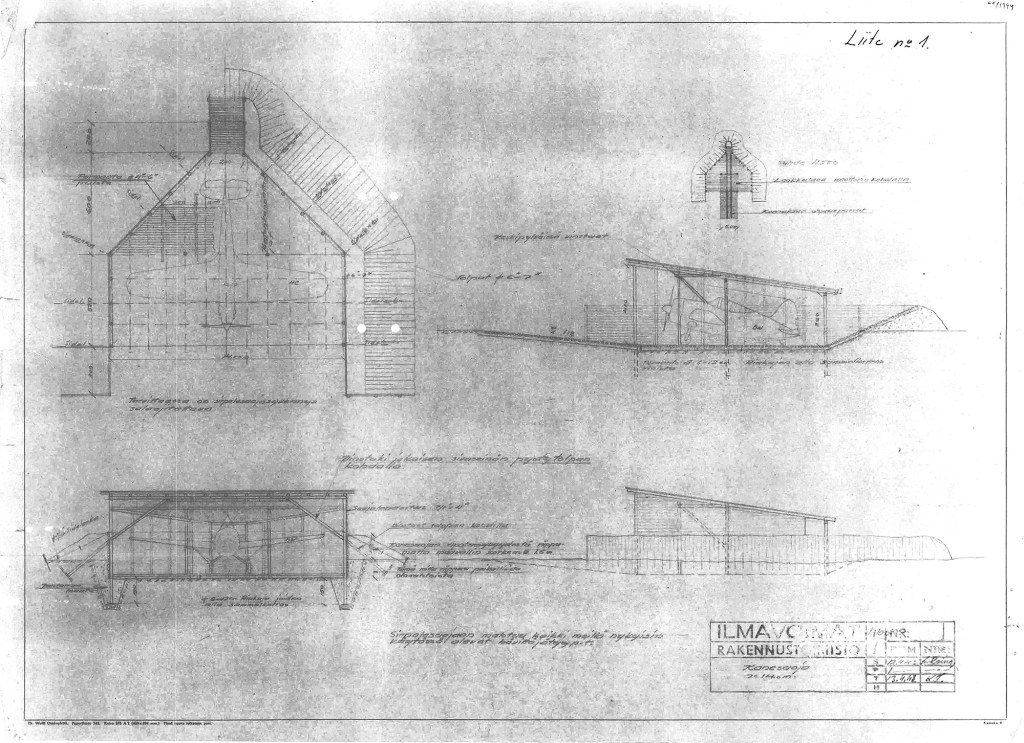
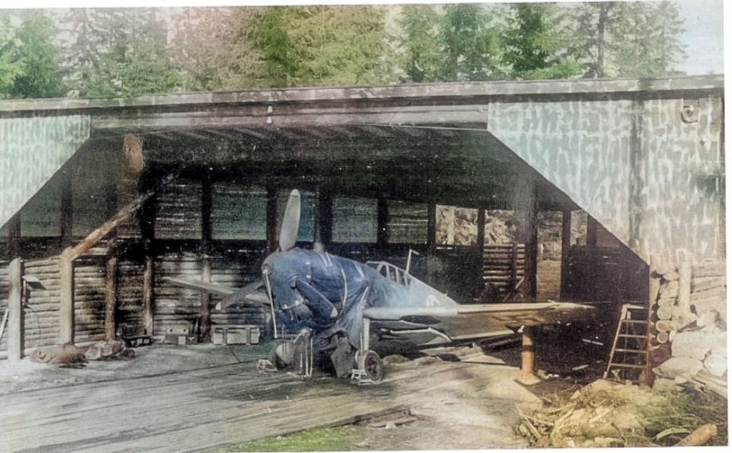
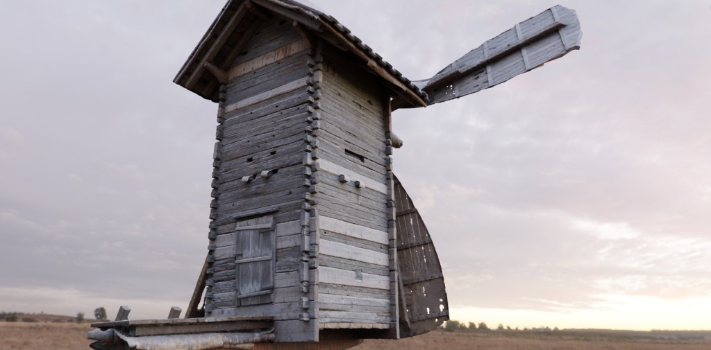
Now let’s have a look at some more work in progress shots featuring airfield plans, photo reconnaissance imagery, architectural drawings, a real world photograph, a 3D model in progress and finally the layout of Taipalsaari airfield as it currently appears in the editor.


Some work is obviously left to do including the completion of that custom revetment. Still, you can see the details beginning to emerge.
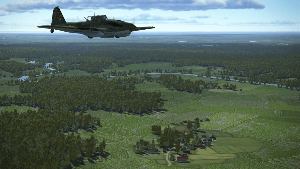
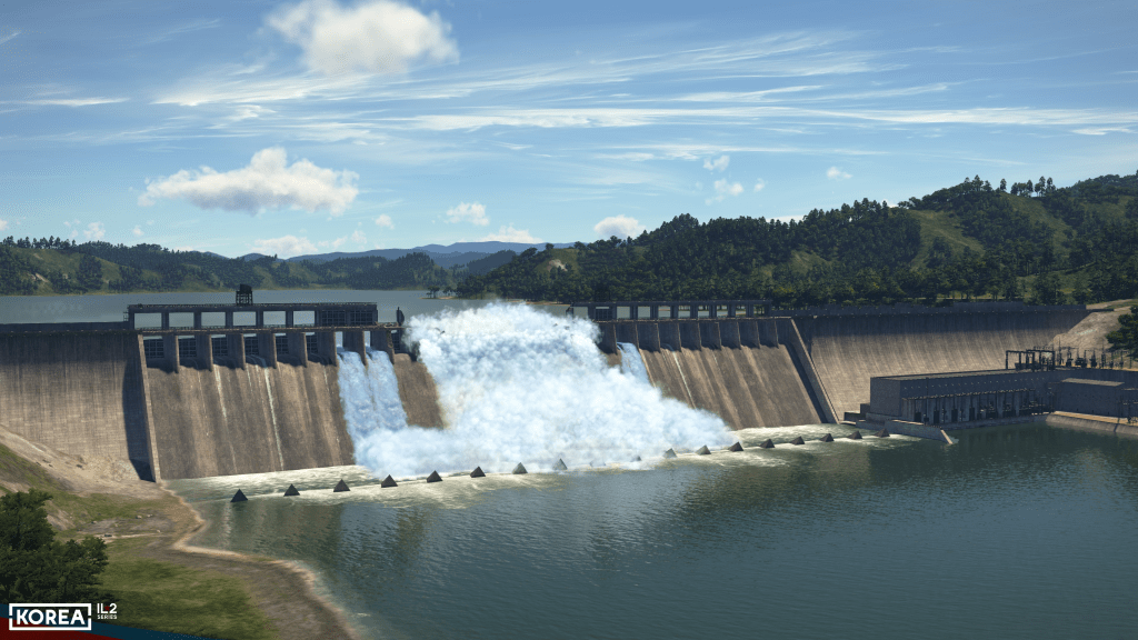
The next batch of shots gives us some more countryside kind of details with more airfields as well as a mix of forests and fields.

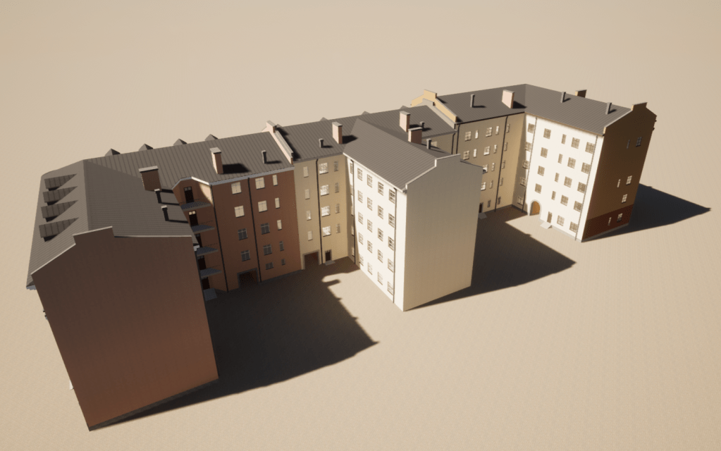
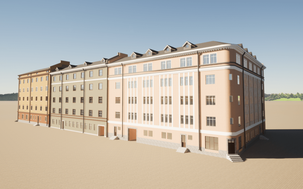
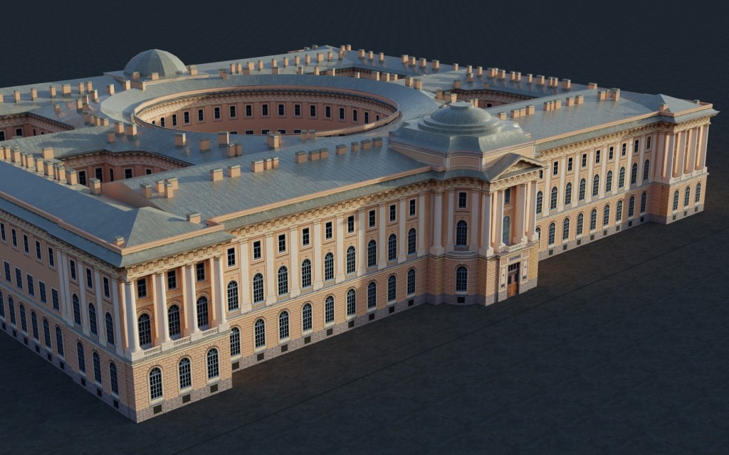
The team have shared some work in progress images of various buildings that are currently being created for the map. The projects start off at relatively high resolutions and then I’m told that the details are tuned down later with the original details being baked into textures.


Finally, a video has been created to show off the project as well.
Content and final thoughts
In talking to the team I’ve also talked to Juri_JS, who is not part of the team but is in contact with them, about the possibility that missions and campaigns will also be created to support the project. The answer is a definite yes. Juri_JS has made several campaigns for the series previously (some of you may have played Ivan’s War or Kerch-Eltigen Operation) and seems well placed to create some content here. That’s good news as a map on its own is a good canvas but the scenery and missions together help to create the experience for most of us.
As you can probably gather from the Q&A, this is a real labour of love for the team behind this project. Over half a decade worth of effort and countless hours spent putting this together is finally coming together in a way that they can show off and talk about.
I want to think Kanttori, Mats and the rest of the KarttaKomppania team for sharing their efforts to bring an interesting new map to the IL-2 series. I also, of course, want to thank them for doing this Q&A with me. It’s been a pleasure to watch their project grow over the last few years with periodic updates. Now that they are talking about it more I’m sure you’ll be hearing both from them and from 1CGS about the project. There will surely be more to come!

Leave a reply to scghvb Cancel reply