I’m calling this an epic because this recent journey that I planned out and then flew in Microsoft Flight Simulator 2024 is is a great showcase of the kind of incredible visuals, real time weather, and fun visual flight rules (VFR) flying that you can do in the sim. The weather, scenery, and experiences were incredible and I loved both the challenge of it and what I saw along the way.
Time for another journal and this was a fun and beautiful one as I took to the air with the and did a flight through the San Juan Islands up into British Columbia, through the Rocky Mountains, and arriving in Alaska. Here’s how it went!
The challenge
For this one I actually challenged a group of friends to join me on a shared journey. They flew a mix of modern flight simulator titles including Microsoft Flight Simulator 2020, 2024 and slightly more classic ones including one flying in FSX. The goal was the same for everyone with flights landing and departing at several airports along the route. A completely asymmetric experience as people flew their flights whenever they had a chance.
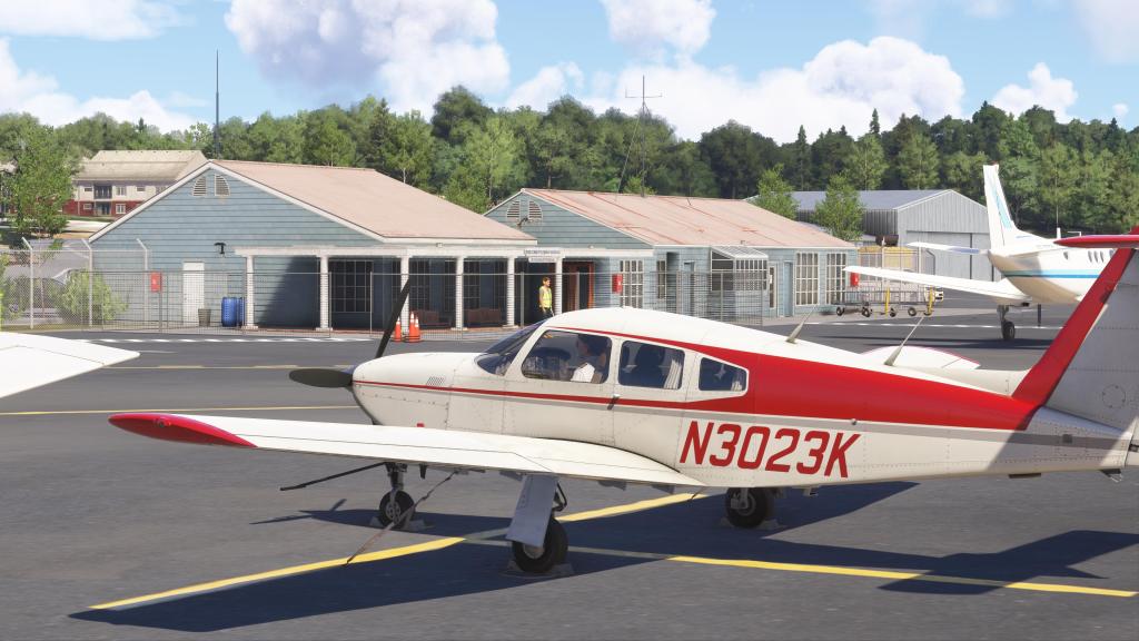
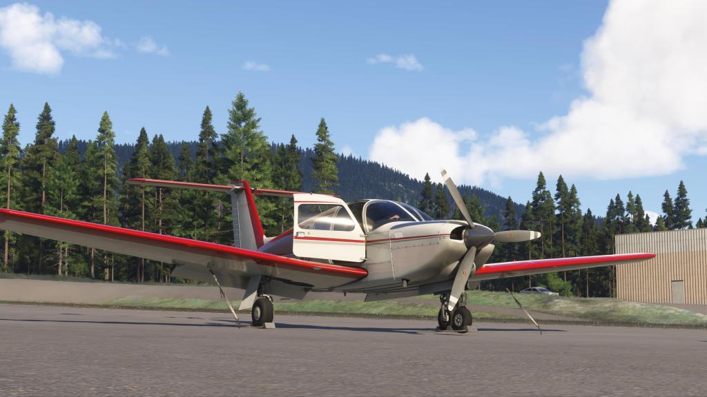
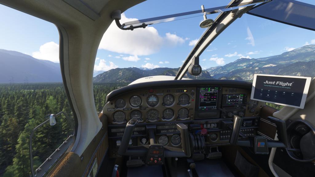
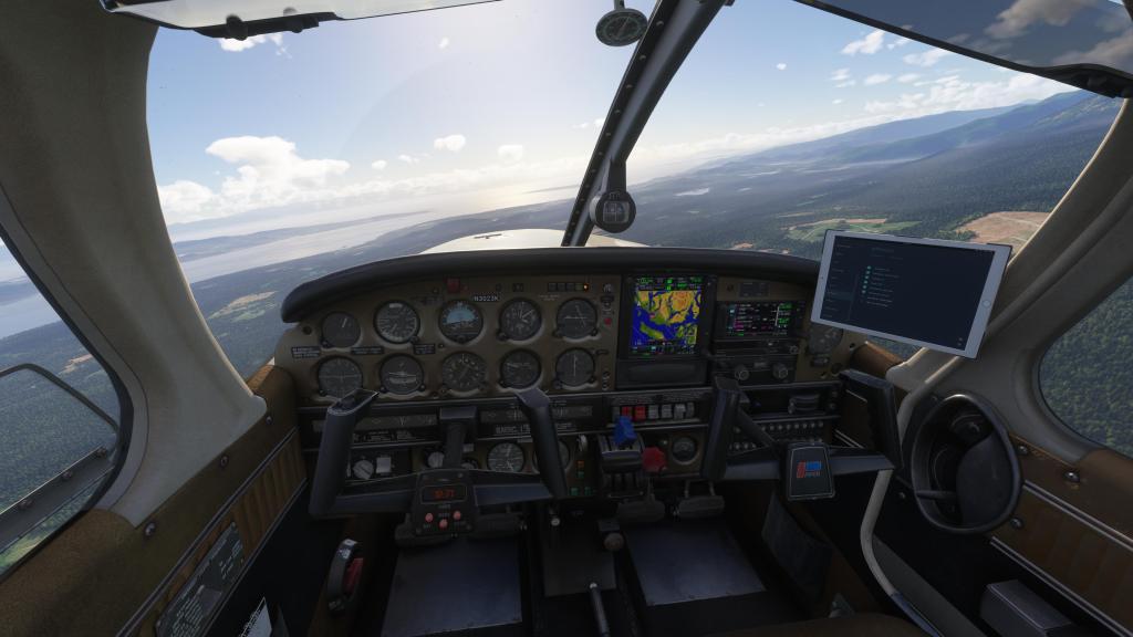
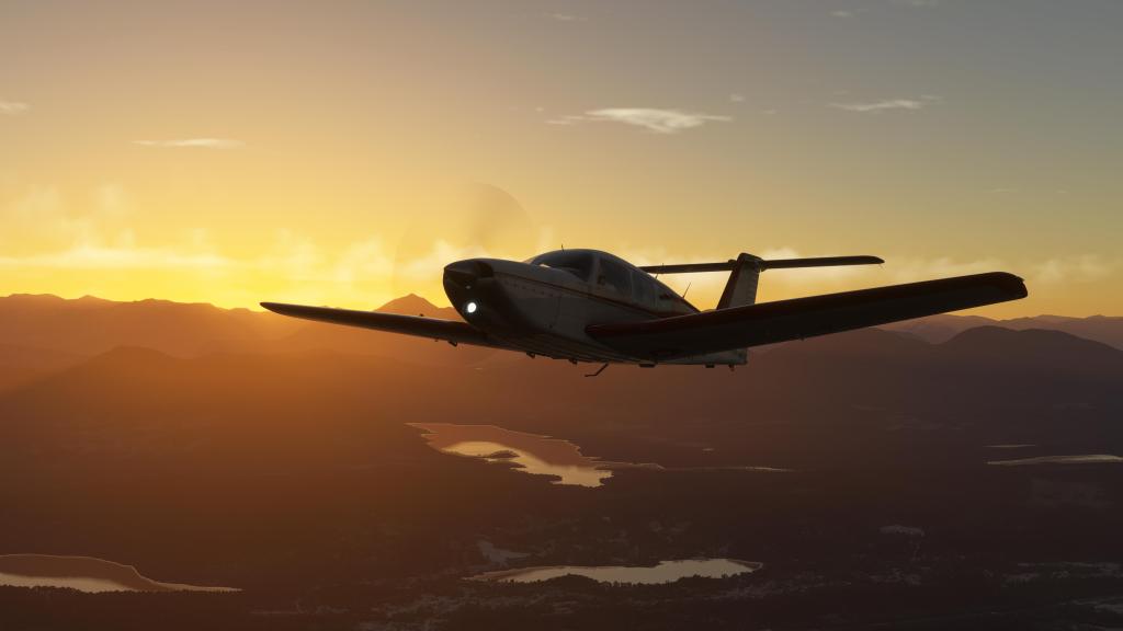
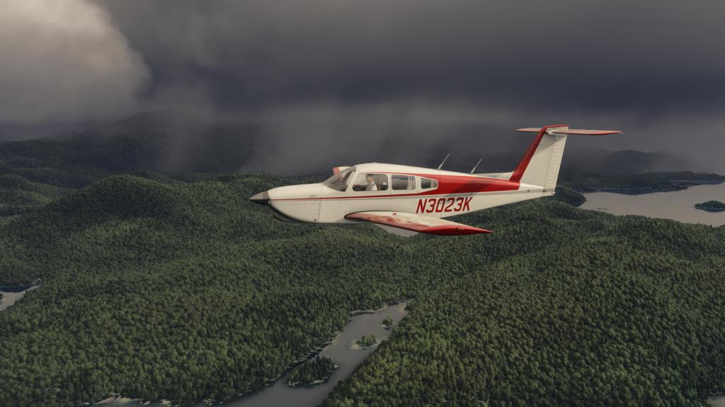
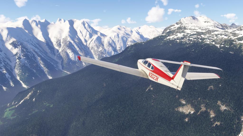
My airplane for this journey was Just Flight’s PA28R Turbo Arrow IV. While its been a bit overshadowed by the freely available Carenado PA28, I’m still a huge fan of both the work and the long term commitment that has seen Just Flight keep on updating the product. Also, this aircraft has a turbocharger and I was flying in mountain country.
I’ve owned this plane since 2022 when I first wrote a review on the type. It’s been refined significantly since then and its also made the jump to 2024. I really wanted to spend the time with the airplane again and I also wanted to better make use of the persistence features as the aircraft tracks engine wear, oil consumption, battery state, and overall state of the aircraft between flights. That means realistic start-up and shut-down are ideal.
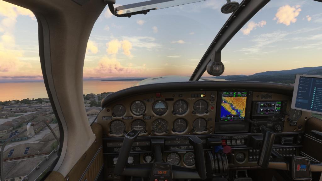
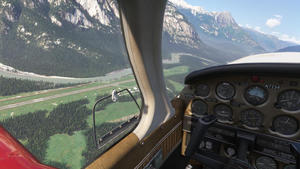
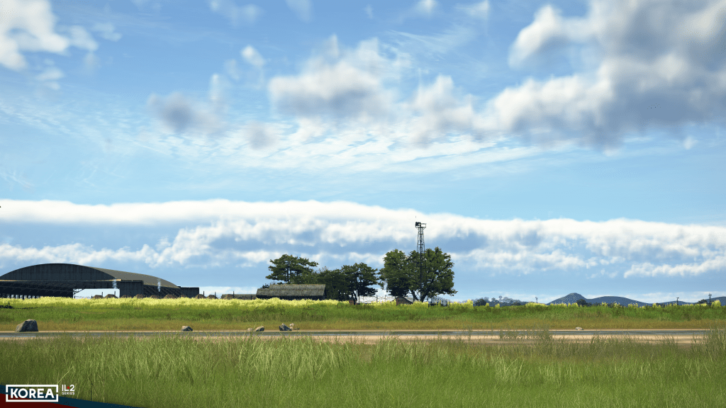
KFHR Friday Harbor to CYSE Squamish
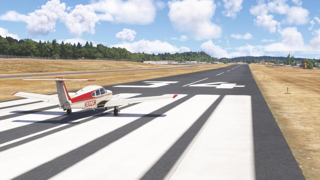
The inaugural flight was an easy and fun one. Departing Friday Harbour located in the San Juan Islands north of Seattle helped kick off this VFR adventure. The airport in MSFS features handcrafted scenery and is a favourite of scenery makers. This is also one of the real world hubs for Kenmore Air and San Juan Airlines of which the former is a bit of a legend in MSFS circles.
After start-up and appropriate checks, it was time to start the adventure. Powering up and taxiing out to Friday Harbour’s Runway 34 I set the trim, advanced the throttles, watched the gauges and climbed into the sky. I was off on this multi-part journey!
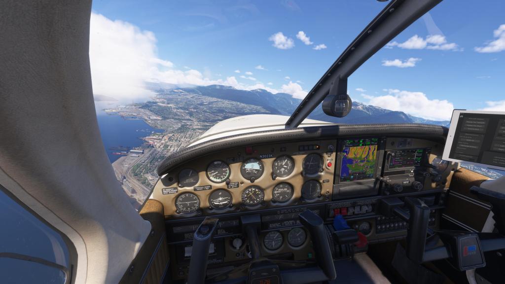
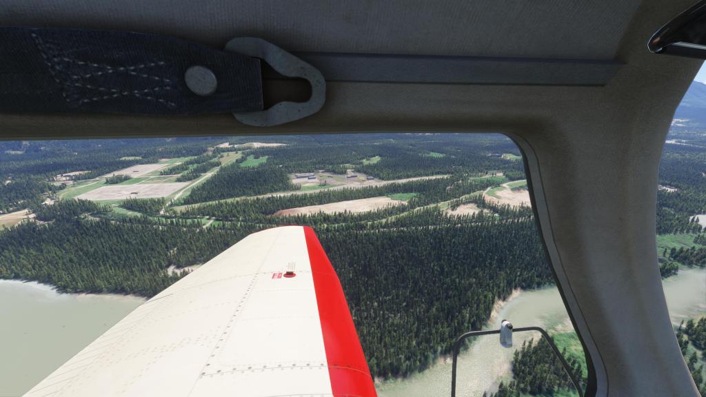
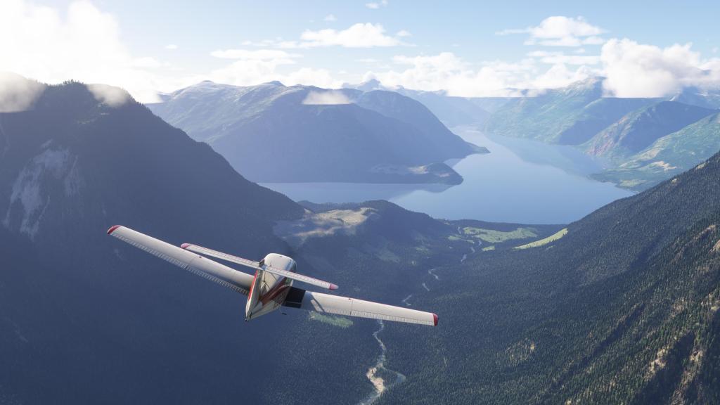
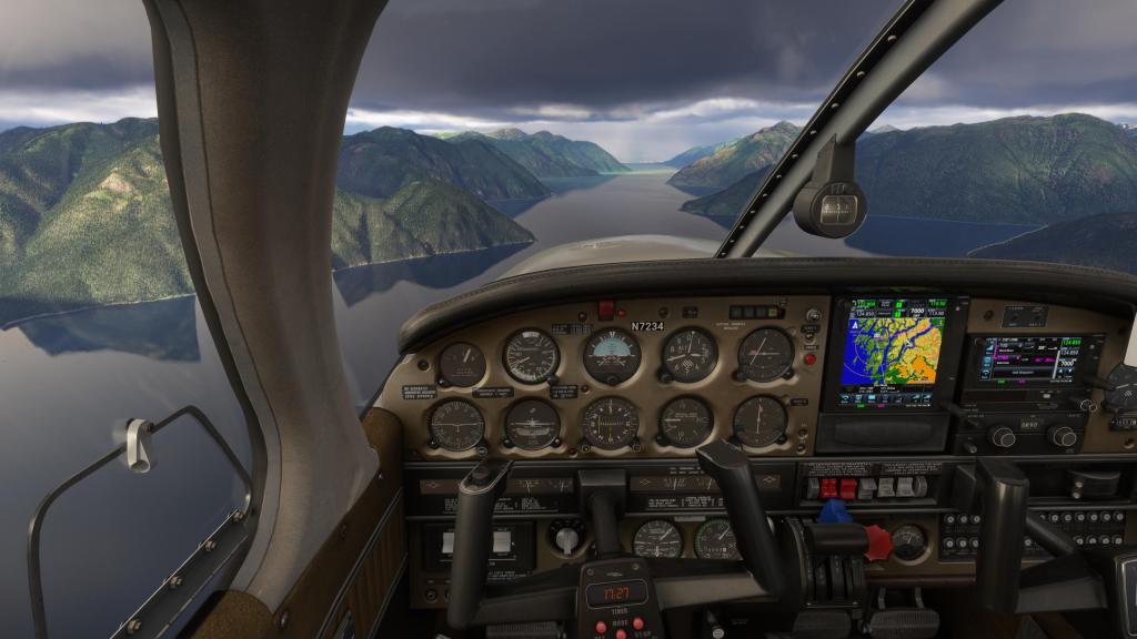
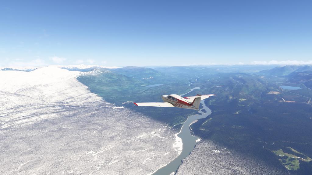
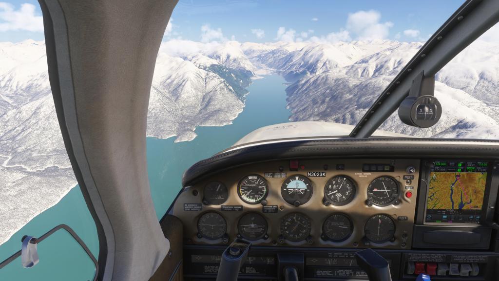
Passing over many of the San Juan Islands, I made my way over the Strait of Georgia before coming onshore near Delta, British Columbia. Minutes later, I was over Vancouver adjacent cities of Burnaby and Surrey. My route then took me to North Vancouver tracing the route of the Sea to Sky highway which you can make out in the sim as a VFR reference. That helped take me up towards my destination of Squamish.
This was an easy landing at Squamish though I had a moment of intrigue as a Buck ran across the end of the runway and into the trees as I was landing. I know there are performance optimization issues with wildlife in MSFS right now but it was cool to have them still enabled and have that moment of unexpected wildlife sighting (you can see it in the background of the second to last screenshot).
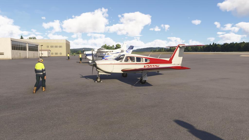
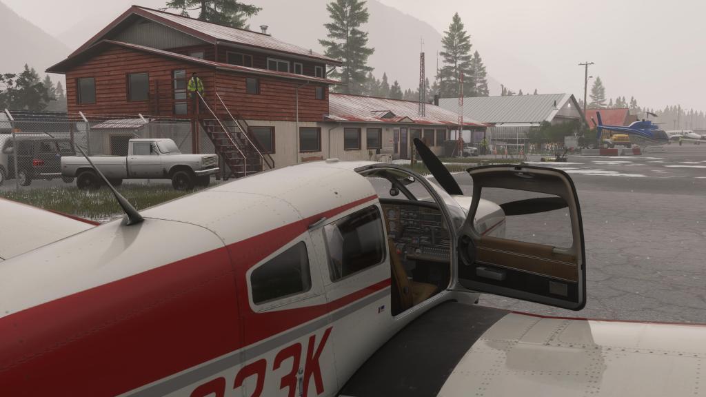
After landing, I shut my airplane down, installed the chocks and tie-downs and called it a day.


CYSE Squamish to CYPW Powell River
Another day and some more beautiful late afternoon weather in the mountains! Off I went on the next part of the journey which would take me from Squamish up to a place called Powell River.
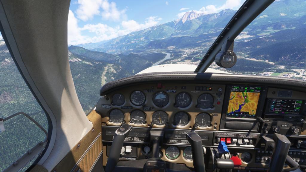
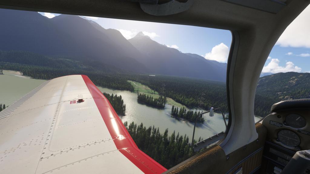
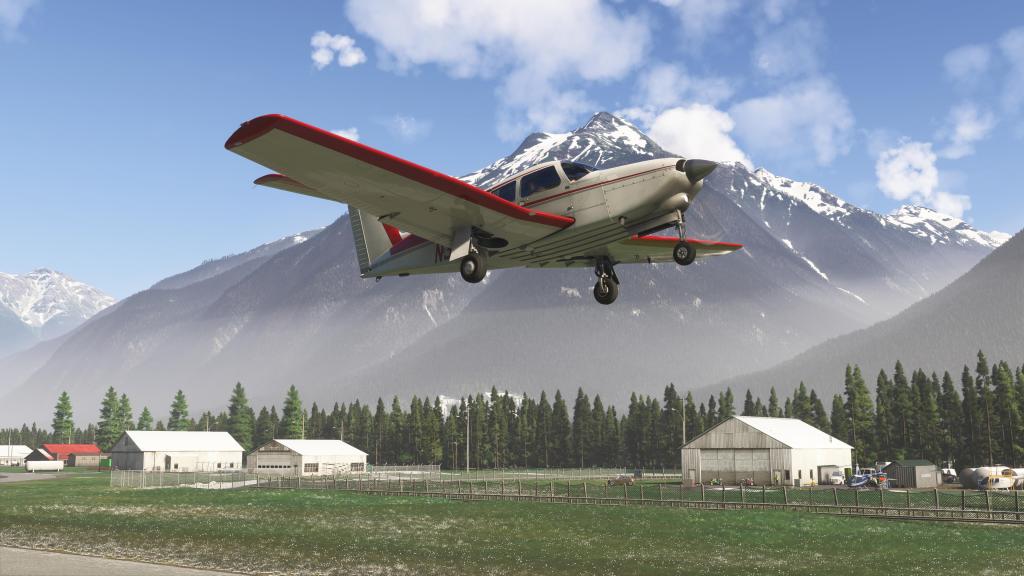
Narrowly avoiding the trees on the short runway and the nearby powerlines, I took the PA28 skyward again and started the first part of the journey. Here I followed the mountains and the route of the Squamish river up past several tall mountain peaks. My course took me past the peaks of Chimai Mountain and Ashlu Mountain before briefly following Jervis Inlet and more tall peaks on my way towards Powell River.
Though not overly challenging, the mountains did keep me on my toes with the aircraft being occasionally rocked by turbulence and either up or down drafts. A reminder why pilot guides for flying in mountainous regions remind that keeping well clear of obstacles is important for ensuring safe flight. Some of those downdrafts can exceed the climb capability of a small plane like this one.
The scenery was once again impressive. Mountains, trees as far as you can see, blue and turquoise water, all very impressive for a VFR flight.
After a short while I approached the more open area surrounding Powell River and landed the plane. MSFS 2024 impresses on flights like these.


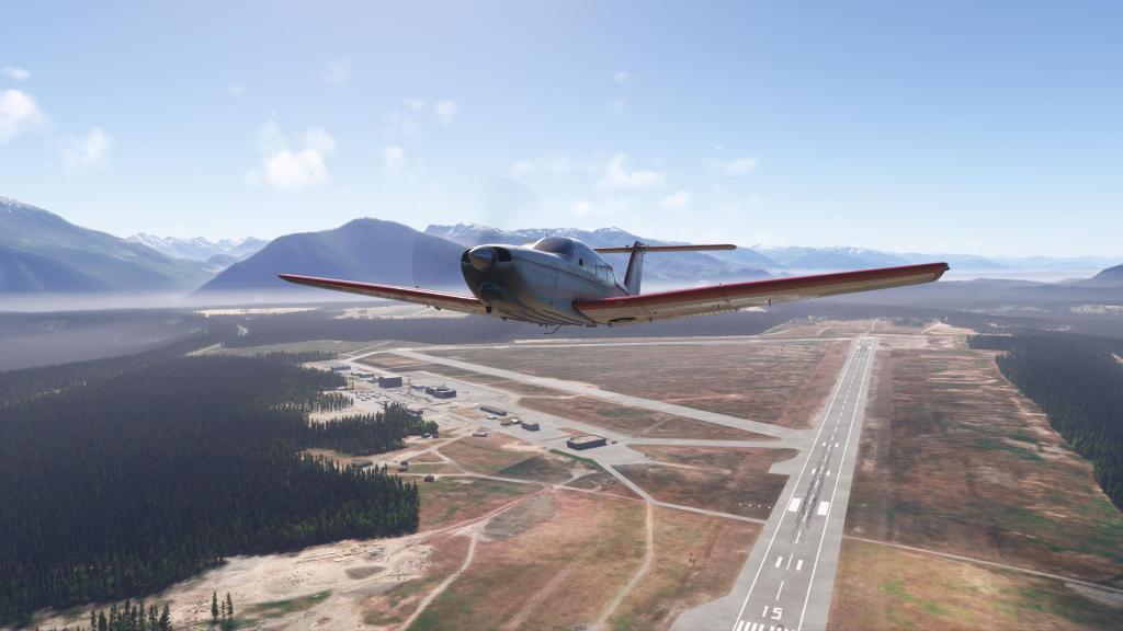
CYPW Powell River to CYZT Port Hardy
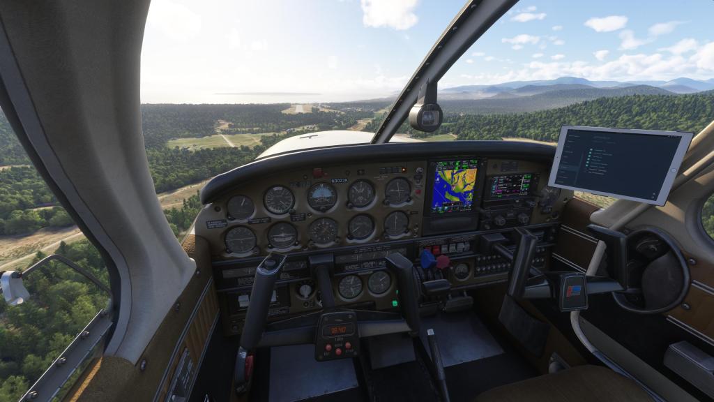
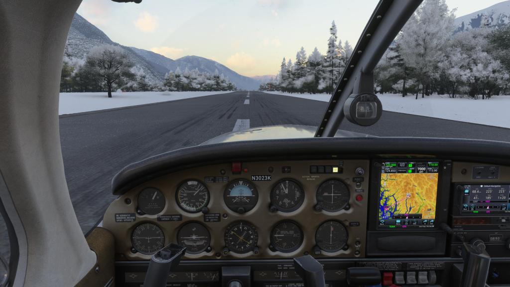
This one was a simple flight. Dawn takeoff from Powell River and a hop across to Port Hardy on the northern section of Vancouver Island. Climbing into the sunlight, I cruised across the straight and made a landing at Port Hardy without any issues.
The weather was calm, there was hardly any turbulence, and it was the easiest and most straight forward of hops.


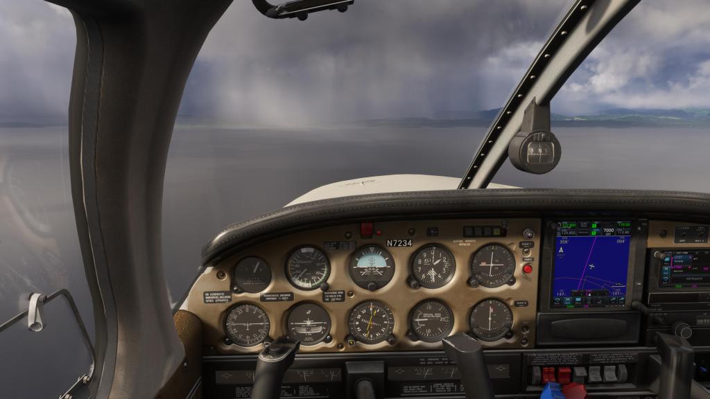
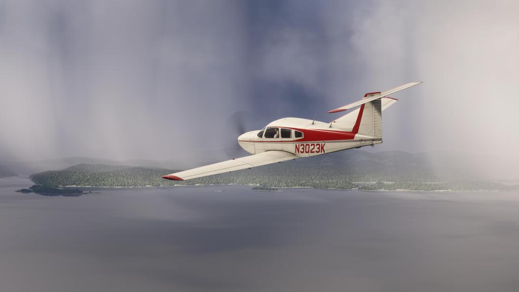
CYZT Port Hardy to CYBD Bella Coola
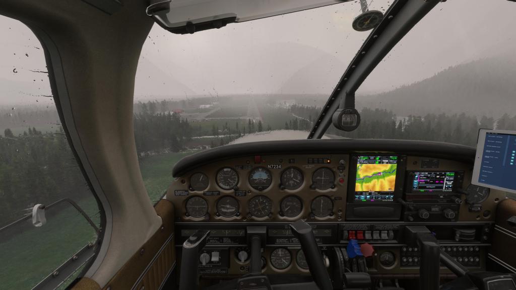
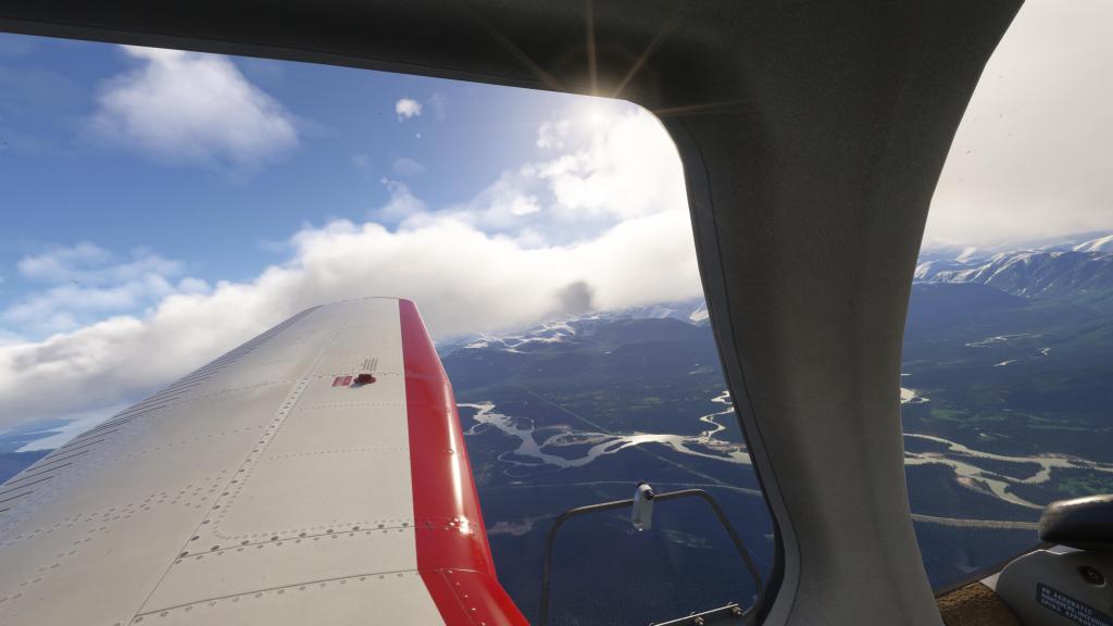
Departing Port Hardy on this leg of the journey was easy and smooth but the weather ahead was anything but. Heavy rain and low cloud deck made safe VFR flying difficult to impossible. I suspect real world rules would have prevented this flight from even occurring but in this counts as adventure in a flight sim like this so I pressed on, dodging rain storms as best I could.
At one point I did cut through a short burst of heavy rain, my vision fully obscured, before emerging on the other side.
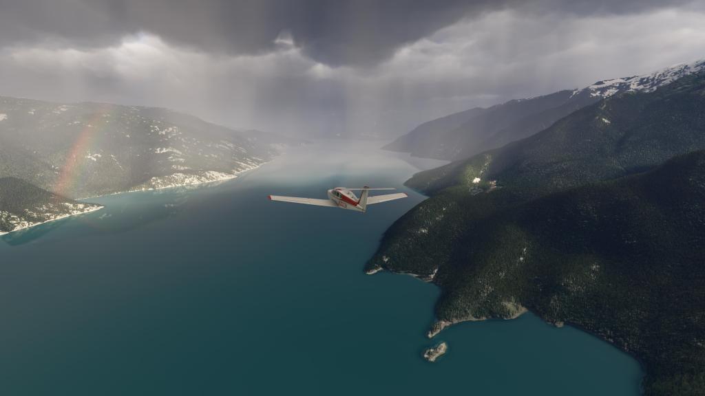
At this point I was out of the worst of the storms and now navigating in the clear and in the fjords on my way up towards Bella Coola.
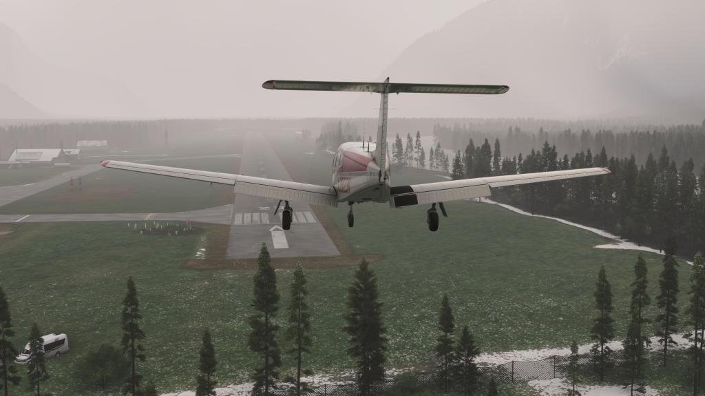
The weather remained clear until my destination where, wouldn’t you know it, another rainstorm awaited. I was able to locate the field and do a clean landing, albeit in low visibility and moderate rain. Phew! That one was a bit intense!


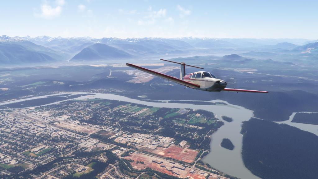
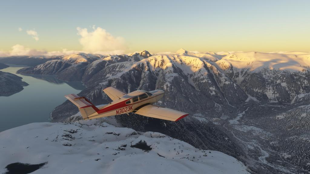
CYBD Bella Coola to CYXT Terrace
It’s several days later at this point and much clearer weather has taken over on the BC coast. Departing Bella Coola in beautiful clear weather with just light haze and some cloud decks to the north, this was an easier flight.
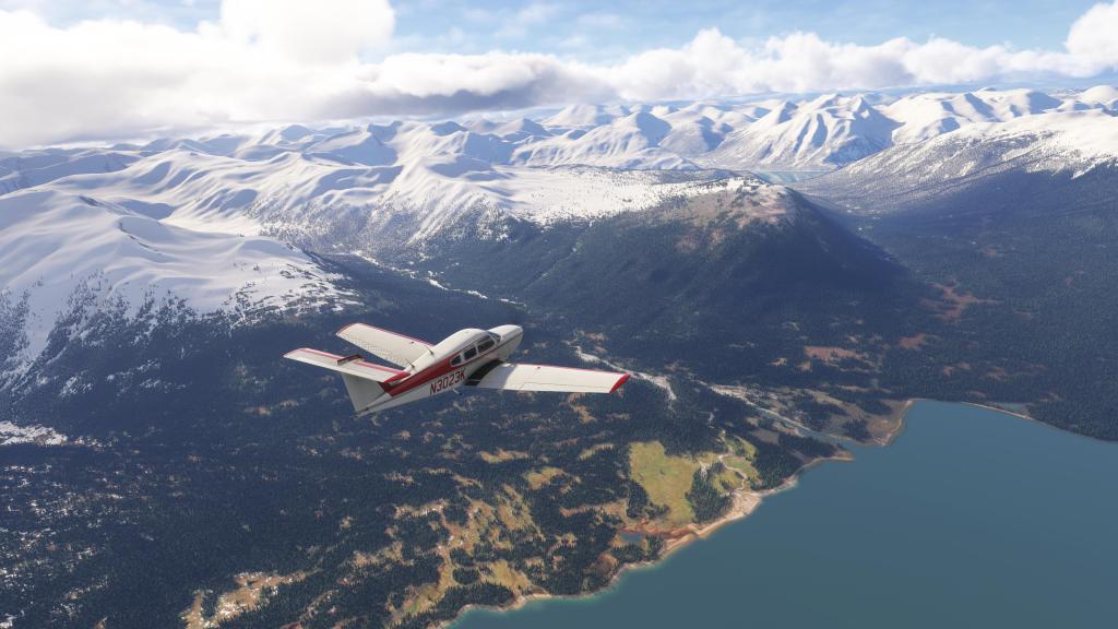
I made my way north climbing up above the mountain ranges on this flight and making good use of the Turbo Arrow’s altitude performance. While non-turbocharged aircraft may have struggled a bit, this aircraft was well suited to getting above the mountain ranges.
The cruise was one of the most jaw dropping flights I’ve done in MSFS 2024. A full showcase of what this sim can do when its working near its peak conditions. Snow capped mountains, blue waters, crisp hill and mountainside textures, and variable weather conditions made for an interesting journey.
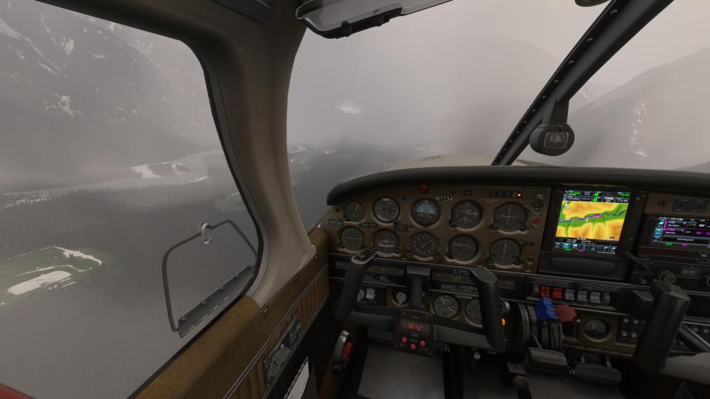
Things got a little more interesting as I ducked down into the channel area on approach to Kitimat. A high level cloud deck made VFR flying a little more dangerous so it was time get under it before arrival.
Fortunately the flight up to Terrace, while moody, was clear and I made a smooth landing at the local airport.


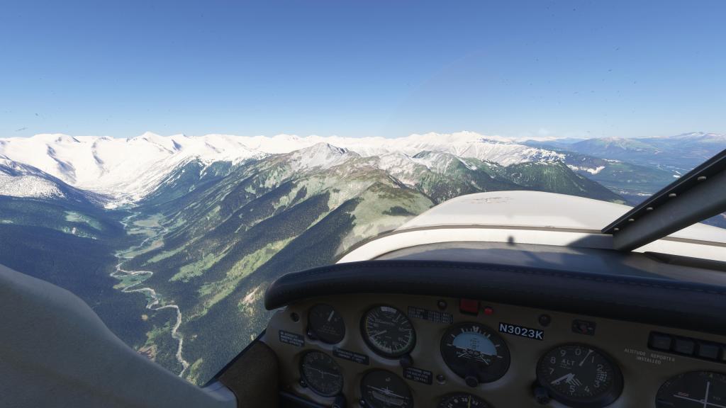
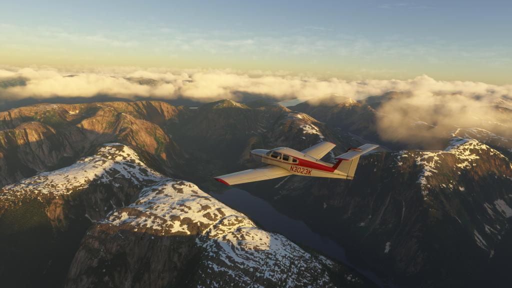
CYXT Terrace to CZST Stewart Airport
It took several days before I’d do another flight. And it was just as well because weather on the west coast had further deteriorated for some of those days. An atmospheric river channelling an immense amount of rain from the Pacific into the area made for poor VFR conditions.
The weather conditions finally let off and clear skies returned just as I was ready to do the next hop.
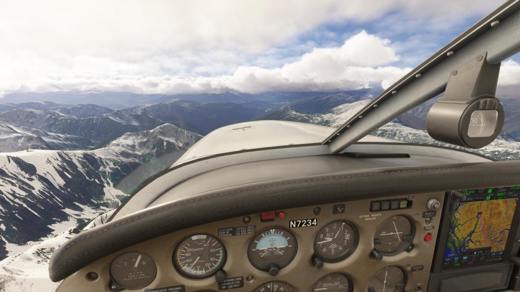
As you can see from the screenshots, this flight took place on another clear day with blue skies throughout the journey. Cruising along the Kitsumkalum River for the first part of the journey, we got into some interesting conditions on the ground where the sim was showing snow. This is because the resolution of the snowpack is lower than ideal and so snow on the mountain gets shown as snow in the valley.
This was even more apparent on approach to Stewart where there was snow everywhere despite the outside temperature registering as 21c in the sim and 20c at the real world weather station at the airport. Still, we have real world snowpack tracking in a sim and I still think that’s cool even when it doesn’t fully work!


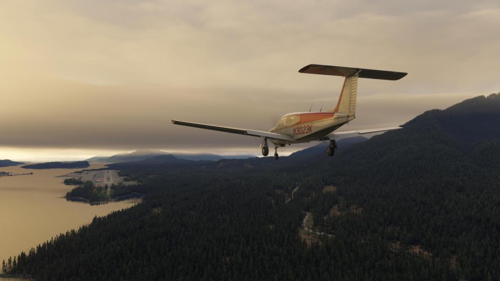
CZST Stewart Airport to PAKT Ketchikan International Airport

After these six previous flights and several hours of flying, the persistence system on the PA28 has shown that I’ve burned 0.3 of a quart of oil. The battery is still giving off 12 volts so that’s great. I’ve tried to treat the engine right by maintaining cruise settings. It seems to have worked though running it rough would have shown off the system better.
This last flight was a bit of a bittersweet moment as the end of the journey was upon us but at the same time its always good to complete the mission you set out for yourself.
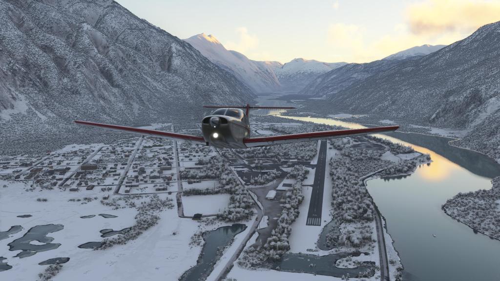
Departing Stewart at dawn, I once again made use of the PA28s relatively excellent climb rate and turocharged engine to get above the mountains and make a beeline for my destination.
The first part of the flight was absolutely scenic as the sun climbed above the peaks and lit up the mountain tops in a beautiful orange glow.
Thicker clouds lay ahead over the ocean and to get into Ketchikan I needed to find a hole. Fortunately one provided itself and I was able to duck through a small cloud layer into clear skies underneath.
A short run along the coast brought me into the scenic approach into the airport and touchdown. This is quite the interesting airport as its used by 737s and other airliners and by smaller craft. The runway is just long enough to handle those aircraft so a Piper Arrow had no struggles to get a nice smooth landing in.
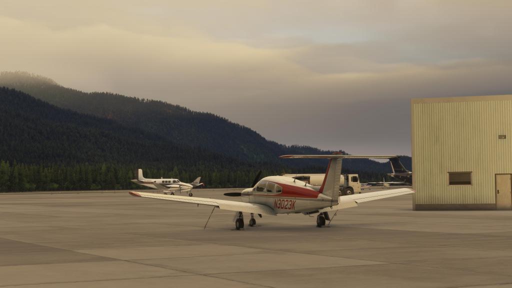
I shut the aircraft down, parked, shut everything off, put in the chalks, the tie downs, and wrapped up the series. Mission accomplished!


Leave a comment