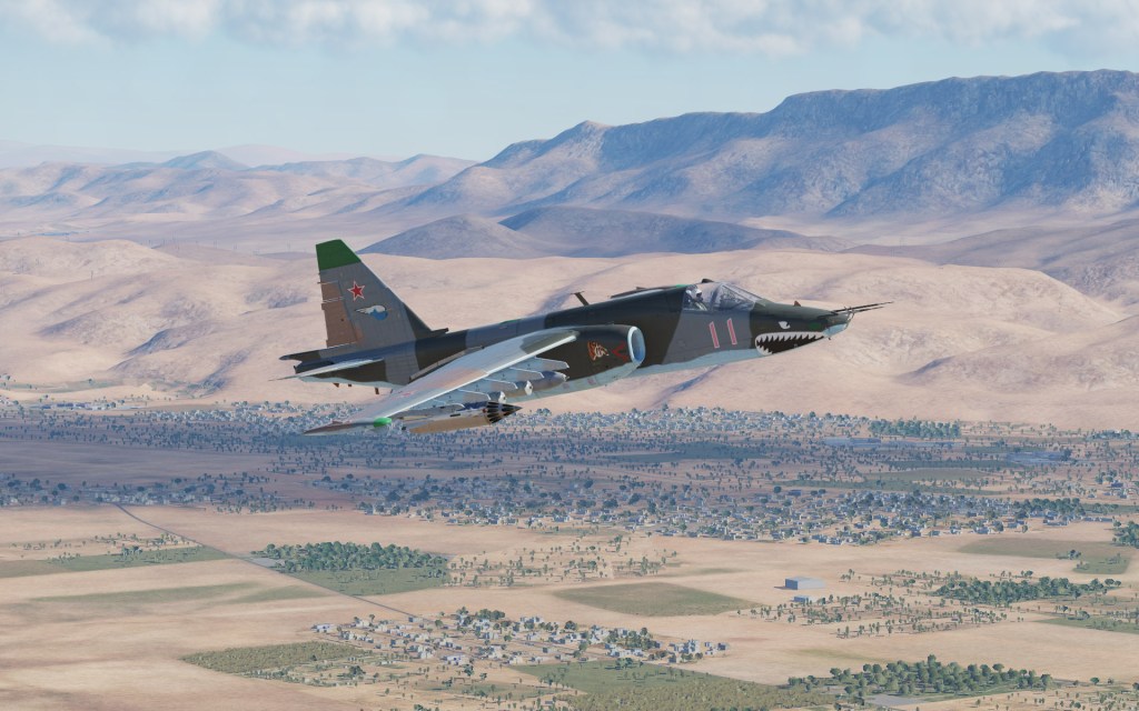
The latest DCS: Syria map video from Eagle Dynamics Matt Wagner showcases another region on the map moving slightly east and north from past videos and into a more arid desert region. The video see’s Matt Wagner flying the Su-25 Frogfoot which has received a very slight update too. Let’s have a look!
Desert interdiction mission
Flying an Su-25 Frogfoot from the Flaming Cliffs 3 package, the Frogfoot has seen a minor update in that the cockpit mirrors have been improved over the old ones. During the video, Matt Wagner confirms that all of the aircraft in Flaming Cliffs 3 have seen minor updates to their mirrors – presumably using newer and better technology as used in other modules.

The mission starts off Marj Ruhayyil airbase located near Damascus and see’s Mr. Wagner take us on a bit of a tour of the base, flying over some of the nearby military installations including a firebase located on the top of a hill, and then on to a target located along a roadway.
There’s also discussion on the mapping technology which uses a similar hybrid “art texture” and satellite overlay that blends together offering good detail at ground level and realistic orthographic scenery at higher altitudes. It’s effective in most places on the Persian Gulf map and seems to work well here too.
What about that release date?
It’s likely that Matt Wagner will finish up his video series before the map releases. He mentioned the Ugra Media recently added trains and road traffic to the map which is one of those final polishing touches that are starting to go in. I’m projecting a mid-August release date based purely on conjecture… it would given Matt Wagner just enough time to release a few more videos showing off more areas of the map.


Leave a reply to Martin Cancel reply