
A couple of smaller items to update on this DCS World Weekend News update. We’ve got a fairly significant update for DCS: South Atlantic. It’s also a thematically appropriate one when it comes to those of us in the northern hemisphere. Then, more on the nerdy side of things, Eagle Dynamics has published another white-paper this time answering some of the community questions on how they have simulated the INS/GPS system for the DCS: F-16C.
South Atlantic update
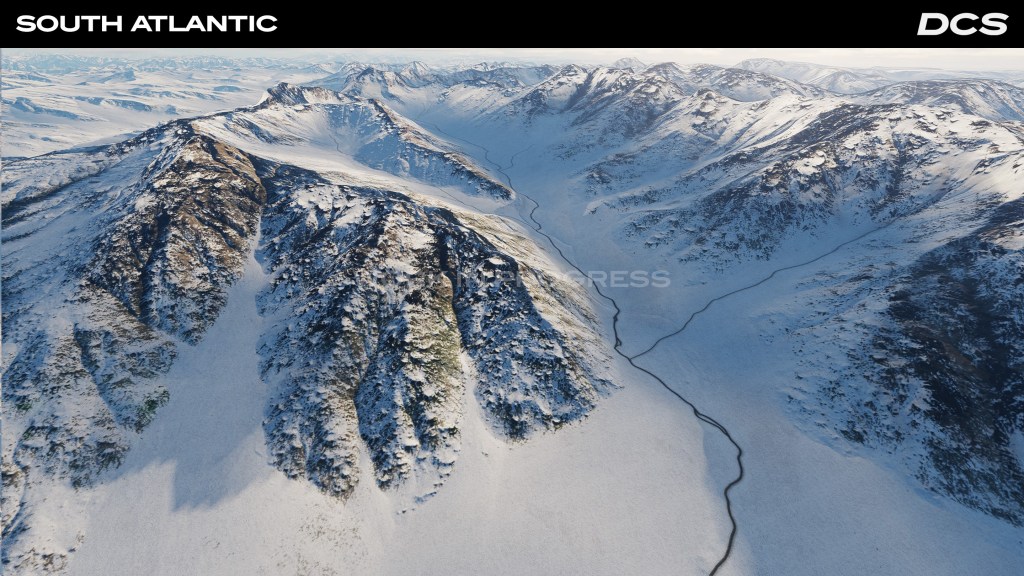

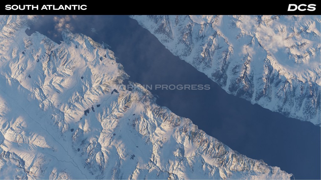
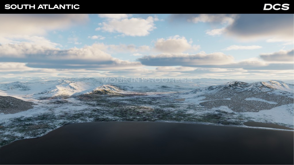
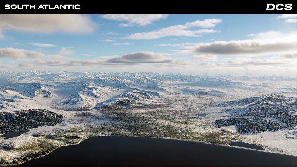
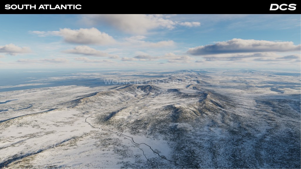

If you like the snow, you’re going to like the looks of the new DCS: South Atlantic update. The map update obviously brings in some new details including a whole new look with snowfall across the map. Areas of the map have also been enhanced with more details for the Falkland Islands and enhanced areas for Argentina and Chile. The snow display in particular is apparently the result of a mix of real world data points and interpolated enhancement where no data exists.
Mainland Chile and Argentina also get many of the same details with a slightly lower resolution.
Future improvements are planned including an updated biome with new flora and fauna visible at lower altitude flight.
F-16C whitepaper release
Apparently many in the community wanted to have more data on how the new DCS: F-16C INS/GPS implementation has been done. So Eagle Dynamics have released a whitepaper covering some of the more technical attributes. The whitepaper discusses, in part, how they simulate INS functionality, GPS signals, Kalman filtering to blend the two datasets, and practical applications.
It’s definitely more on the nerdier side of things but that’s ok. We all like simulated airplanes! Read the whitepaper right here or check out the full DCS World Weekend News update here.


Leave a reply to PaperPilot Cancel reply