I’m very pleased to be able to share with you all a preview of the upcoming DCS: Normandy 2 map by Ugra Media. This is a much bigger, more ambitious project than the prior Normandy or The Channel maps that we’ve had access to before and that means that this preview that I’ve put together is going to come in two parts. Part one will look at the new southern England section of the map and then in part two we’ll look at Normandy. Let’s go!
The big picture
It goes without saying that this is a preview of content that has yet to release. Things could change in big or subtle ways prior to launch so keep that in mind as you have a look at what I’ve seen so far.
Ugra Media and Eagle Dynamics surprised us all in the DCS World 2022 and Beyond trailer when they showed us images of Big Ben and the Eiffel Tower. Later confirming the existence of DCS: Normandy 2, a wholesale reworking of Ugra Media’s original Normandy map, a lot of us had questions on what the plan was with this map. Now that its in preview and I’ve had a chance to look it over I wanted to start with the big picture.
Normandy 2 focuses a lot of its efforts on the same areas from the original and then extends those outwards. High detail areas extend north from the original zone into England going as far north as London and it expands them south and east to include Paris. Lower detail zones still have details but not at the same level.
This graphic, provided by Ugra Media on their Normandy 2 FAQ, should give you a good sense of what we’re looking at.

According to the information I have, Normandy 1944 and The Channel Map had 39 and 27 airbases respectively. The new Normandy 2 map extends that number to 69 at launch with that number increasing to 89 by the time of completion.
Three seasons are included in this version of the map. Spring, summer and fall give the map a bit more range of experience with each season having different foliage, and subtly different scenery textures that blend well with the season. Spring has those bright and optimistic greens that you get around that time while summer is still green but a deeper shade and then autumn leans more into that classic burnt orange feel.
All in all, this looks like a replacement for the original Normandy map while greatly expanding the map in all respects. It also doesn’t fully replace The Channel (at least as is presented) as the highly detailed zones cover different areas.
That’s the big picture but now on with the preview of the northern high detail section featuring the south of England and London!
The coast
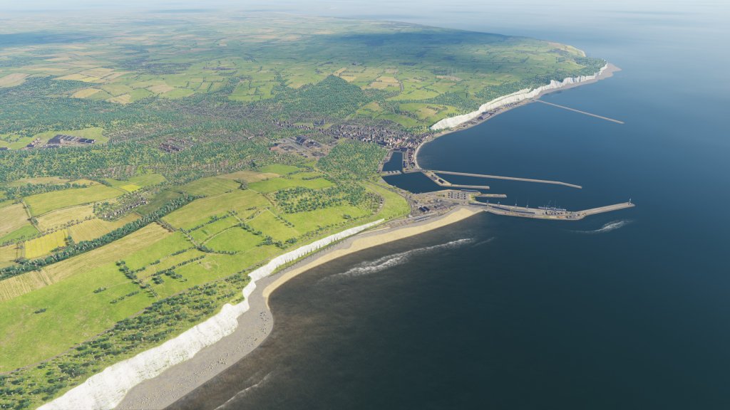
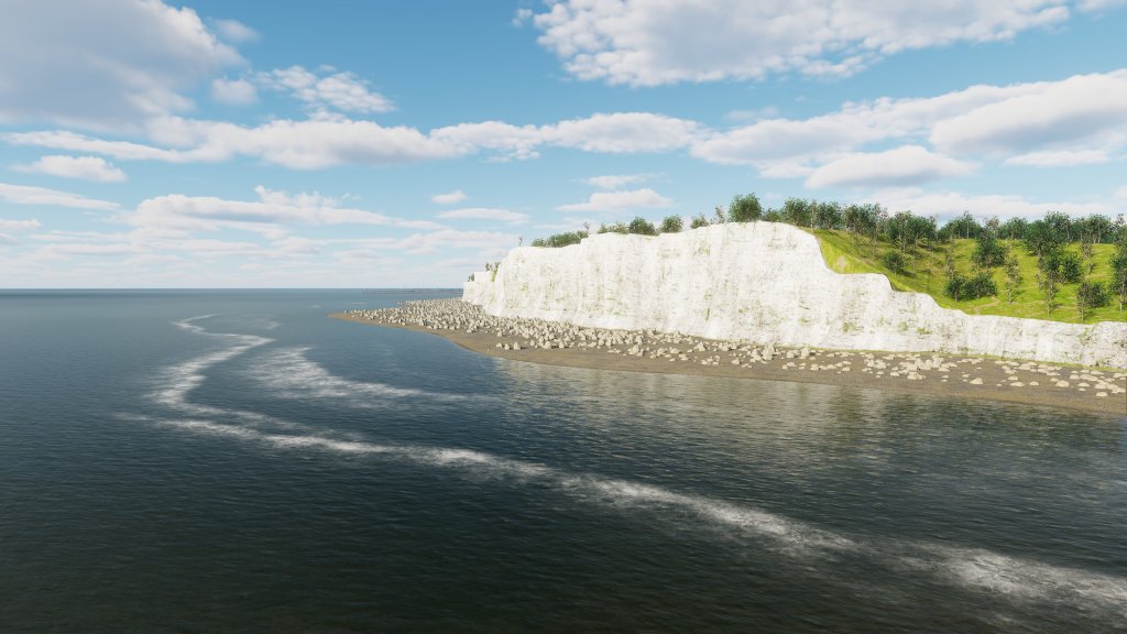


Urga Media did not initially include England at all as part of the original Normandy 1944 map release but feedback from the community saw them add basic terrain along the northern edge of the map giving us airbases to fly from in England. Normandy 2 completely reworks this zone giving us all of the details that you’d expect along the coast and beyond.
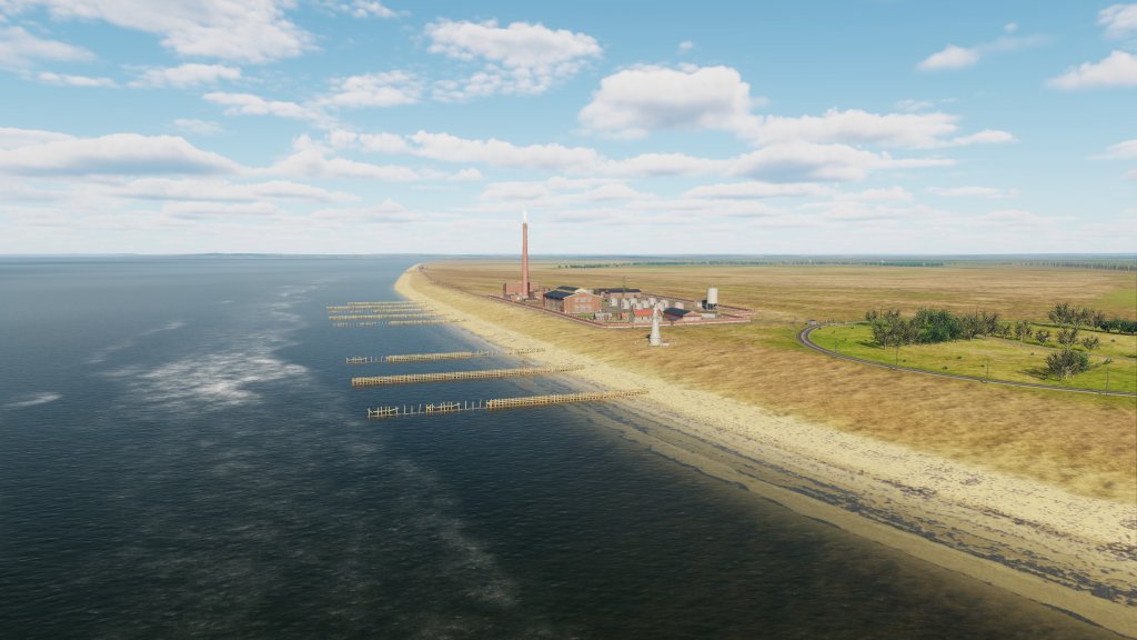
You can see some of the coastal regions represented above with notable landmarks like Dover and the Chain Home radar installation, the white cliffs, Dungeness and the Romney Marsh, Eastbourne and more.
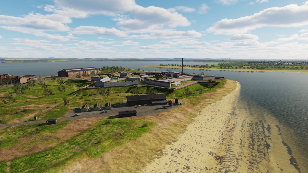
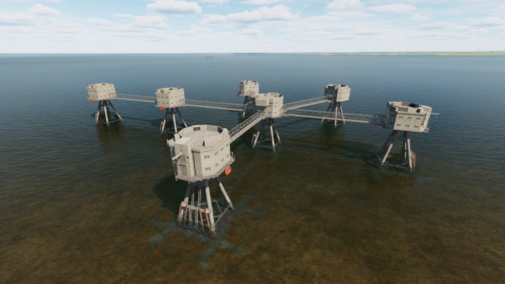
There are towns and villages, forts, lighthouses, and all of the other landmarks you’d expect along the coastal region in the south of England. Also receiving detailing are the infamous Maunsell Forts on the sea approach to London and the Thames River.
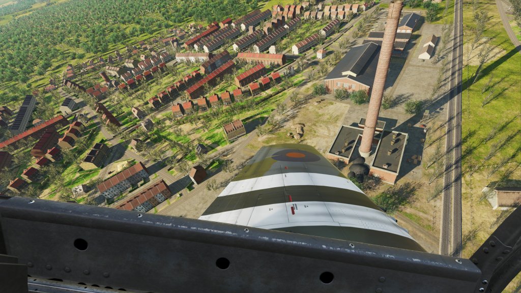
London!
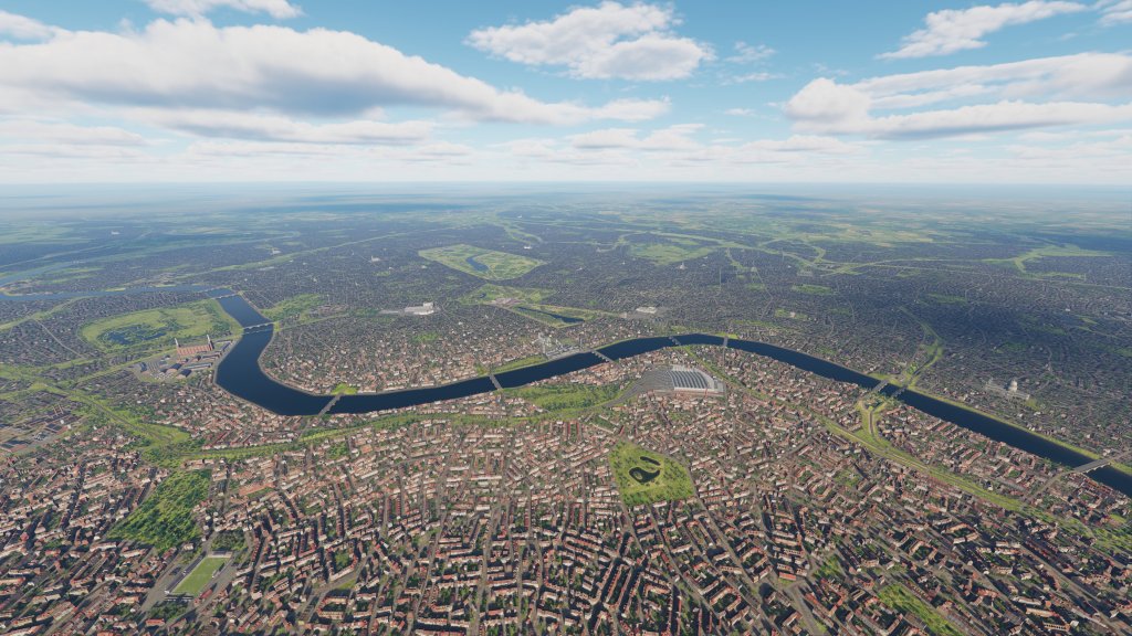


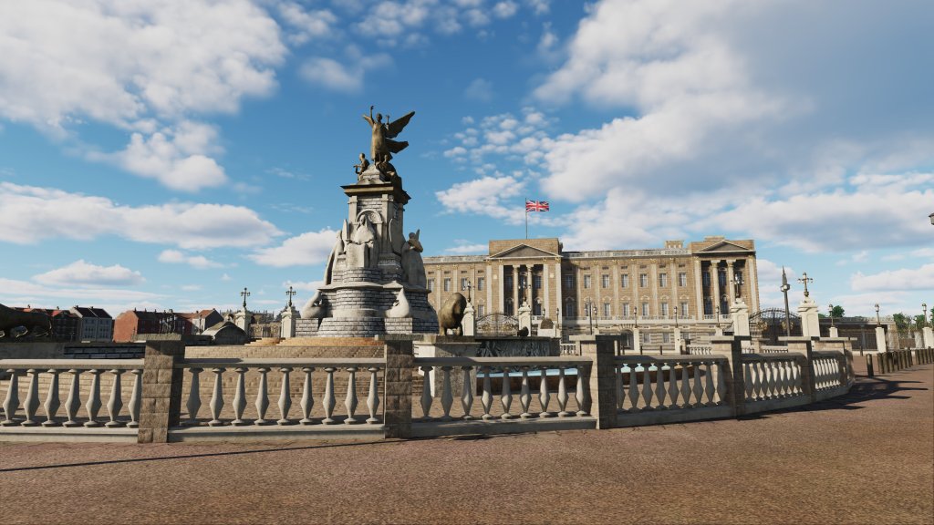


One of the highlights for me was seeing London on the map. Although air raids on the famous capital city were rare in 1944, having London does make the map feel complete and I know many of you will want to go for a joyride over the city early on.
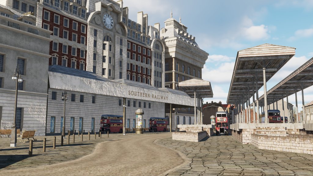
As you can see, the map has plenty of key landmarks. Buckingham Palace, the Victoria docks, the Tower Bridge, Trafalgar Square, St. Paul’s Cathedral, along with dozens and dozens of different assets that include rail stations, the famous London double decker busses and on.
Airbases
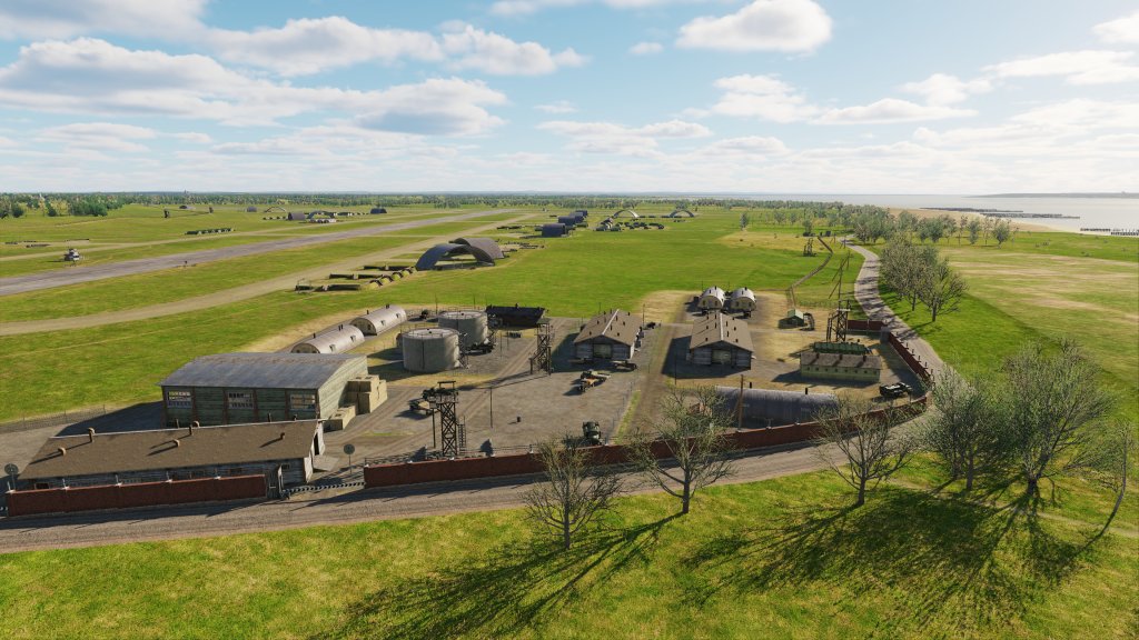


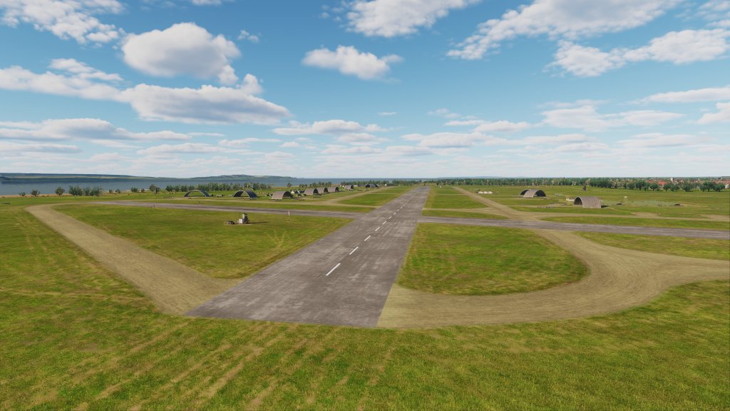

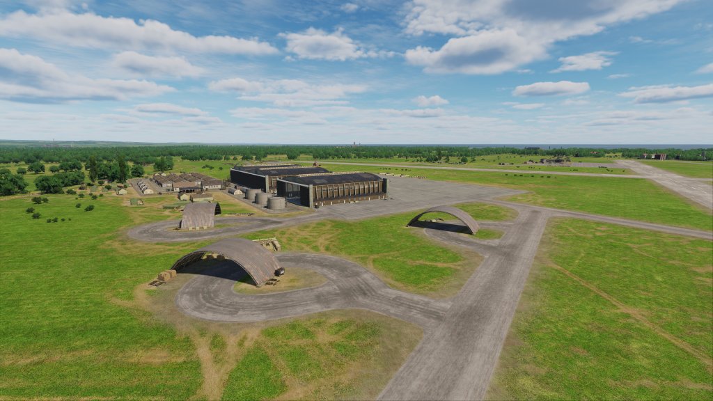
There’s about a dozen airbases to check out and I haven’t been to all of them yet but I did have a close look at a few and you can see from the above images that there are quite a few details here.
There are a wide variety of hangars, outbuildings, overhangs, sandbags, tents and temporary buildings and more. A lot of detail has been packed into these airbases with both grass and paved options showing suitable levels of wear and tear on the pavement and on the grass.
Here’s the list of England based airbases you’ll be able to fly from:
- Chailey
- Farnborough
- Ford
- Funtington
- Gravesend
- Heathrow
- Kenley
- Needs Oar Point
- Tangmere
- West Malling
- Deanland
- Friston
- Lymington
- Odiham
- Stoney Cross
Other details

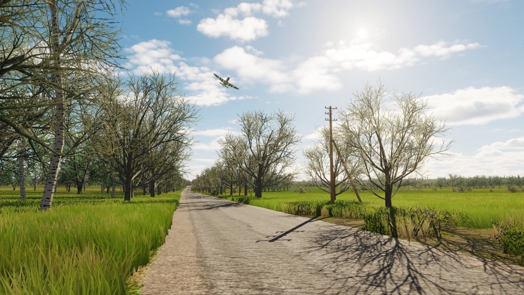

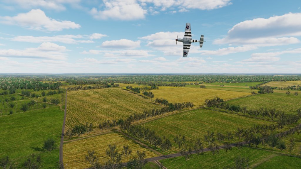
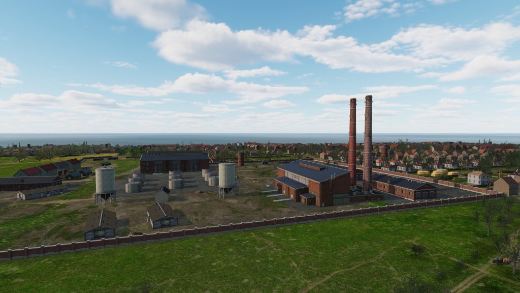
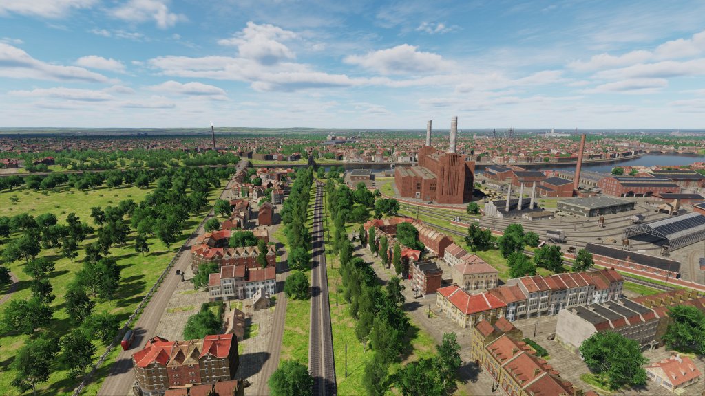
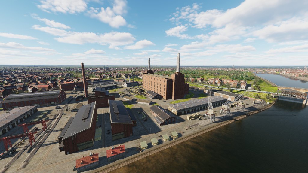
The south of England is and was a mix of urban, suburban, industrial, and rural zones with rolling hills, beaches, rocky cliffs, and quaint country roads. You can see clearly all of those represented in the above screenshots. There’s a lot of life here with vehicles, crates, piles of dirt, storefronts, benches, and other details all crammed into the visuals here.
From low to high altitude…there’s quite simply a lot to see!
Stay tuned for part two as I explore France and Paris in my second preview of Normandy 2.

Leave a comment