DCS: Normandy 2 preview part two!

Back again with DCS: Normandy 2 preview part two! In part one I explored the northern sectors of the forthcoming map for DCS World with a look at southern England, London, and The Channel coastline. Now in part two we’re exploring Normandy, the French coastline and Paris! Allons-y!

The Normandy coast

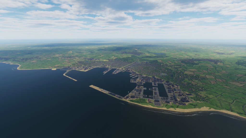
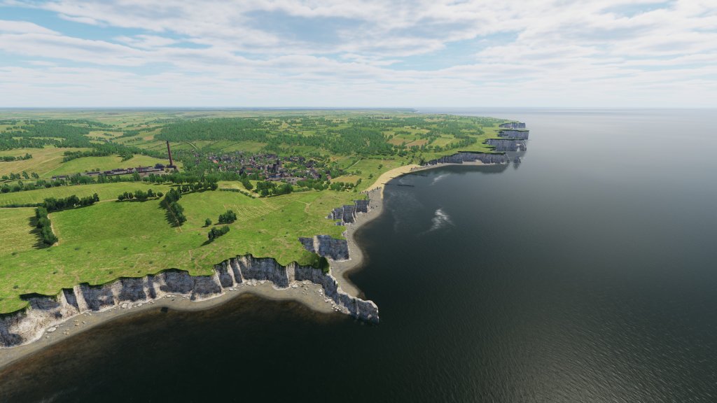
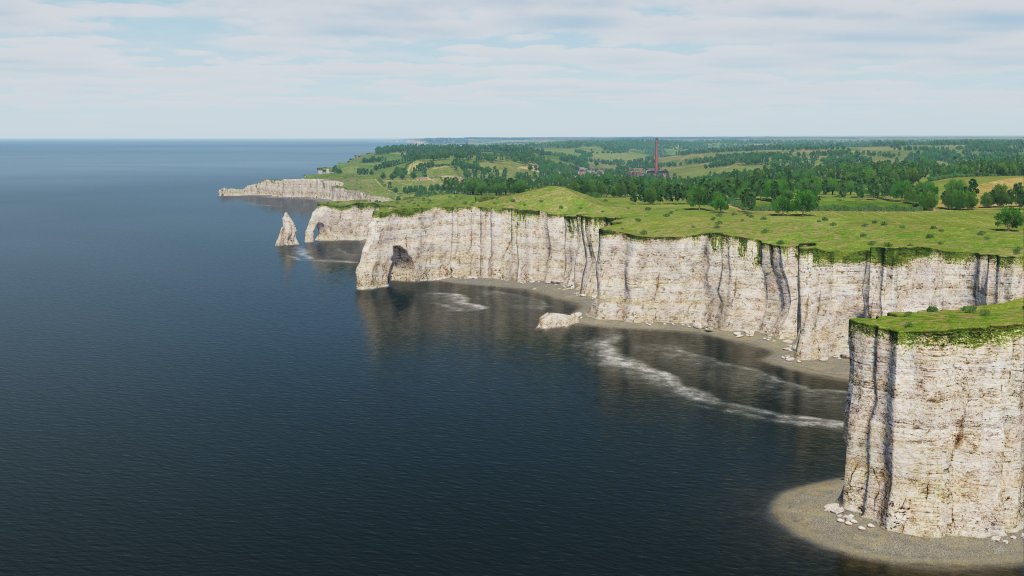
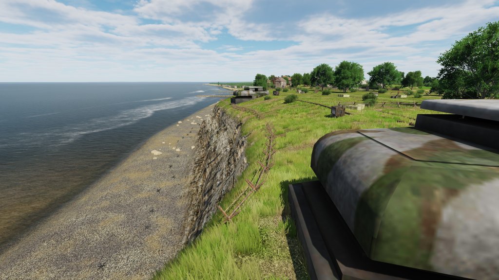
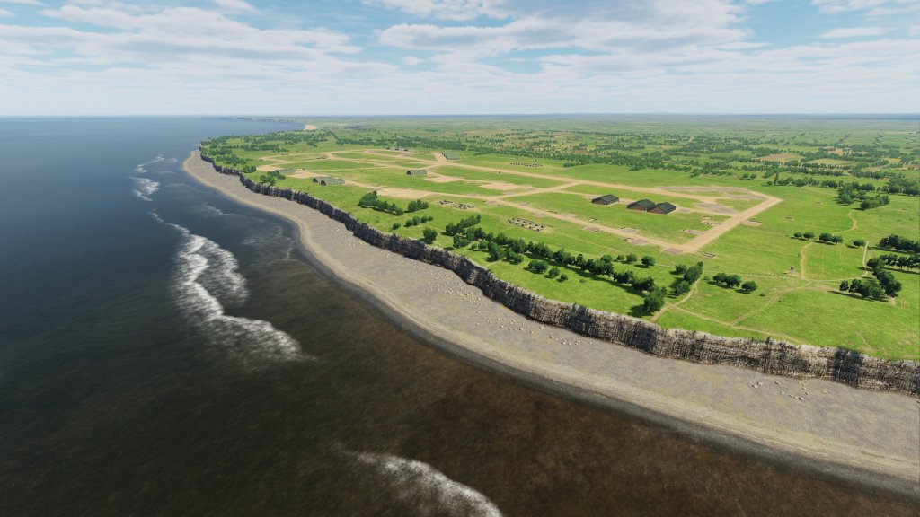
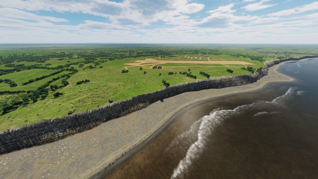
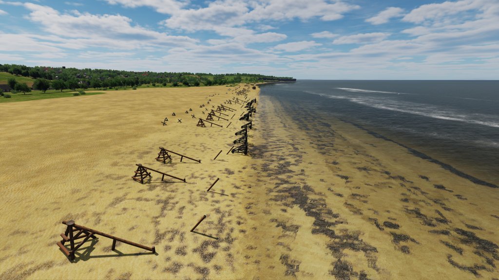
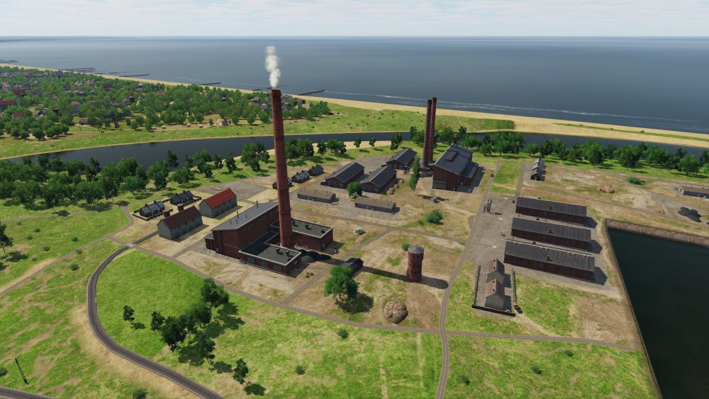
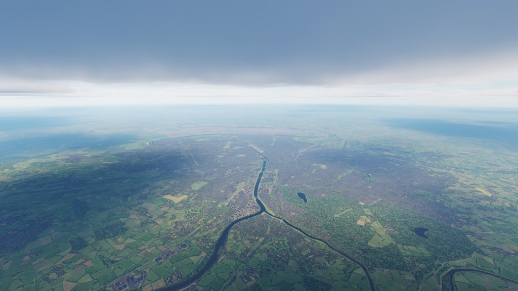
A significant section of this map is the Norman coastline with high detail areas stretching roughly between two port cities: Le Havre and Cherbourg-en-Cotentin. Located between them are the famous battlefields of the Operation Overlord D-Day invasion that are known well across the innumerable books, movies, films, and stories told about the battles on these shores.

I am not a battlefield historian but it does look like Ugra Media have spent quite a bit of time detailing both the surrounding countryside, the towns, cities, and ports of this region as well as their battlefields.

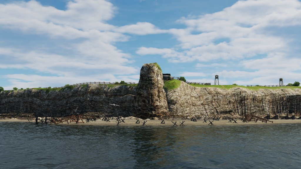
Famous locations such as La Pointe du Hoc, Carentan, Bayeux, Caen, and more are represented along this segment with all of the detail that we saw from the English side in part one. There’s also Utah, Omaha, Gold, Juno and Sword beaches which all have authentic appearing fortifications including bunkers, dragons teeth, and other obstacles all aimed at making the Allied invasion difficult. The only thing I haven’t spotted in this preview are the Mulberry Harbours although I’m sure an intrepid mission maker might be able to approximate one.

Check out these screenshots along this section of the map.
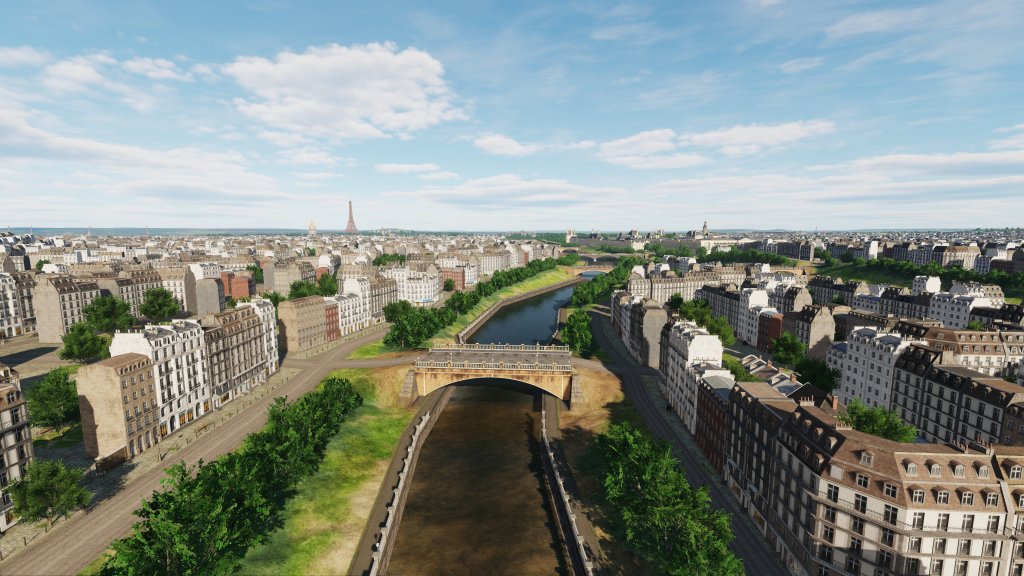
Paris

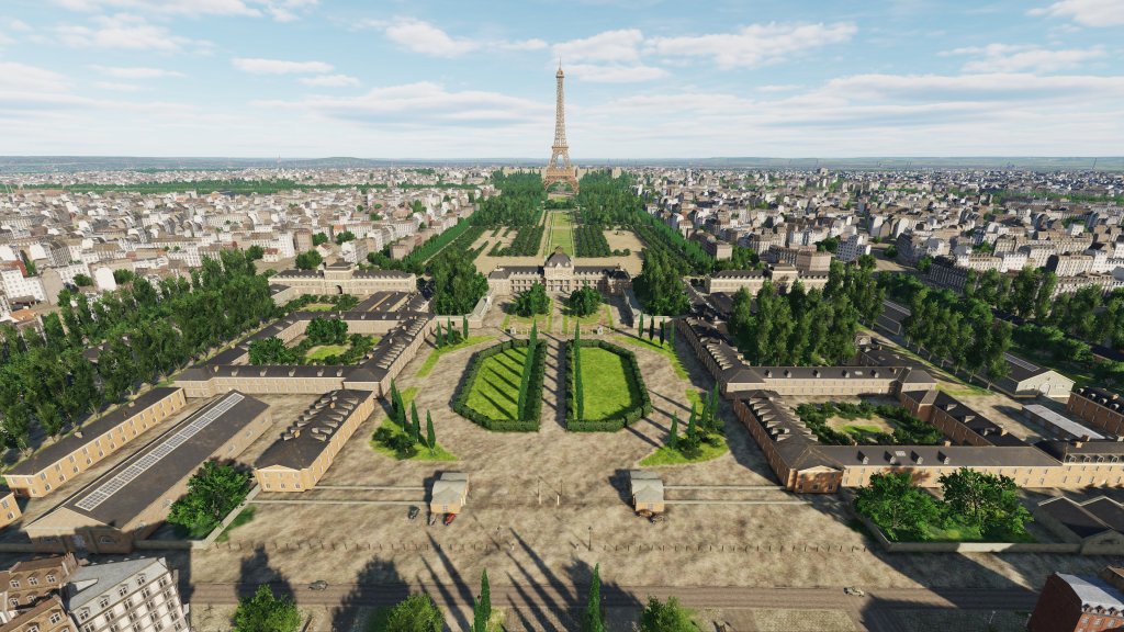
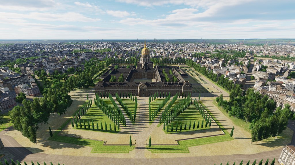
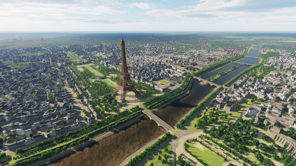
A major European city, capital of France, the city of light, and home to plenty of famous landmarks known worldwide. Paris, like London, has been given a detailed pass by the Ugra Media team. The Eiffel Tower, Panthéon, Palais Garnier, Arc de Triomphe, Musée du Louvre, Notre-Dame Cathedral and more are all there and rendered in quite a lot of detail.

The city boasts classic Paris style architecture that you’d expect of a realistic rendition of the city. There’s also famous horse racing facilities, industrial sectors, the scenery around Versailles, and of course the french countryside surrounding the famous city.
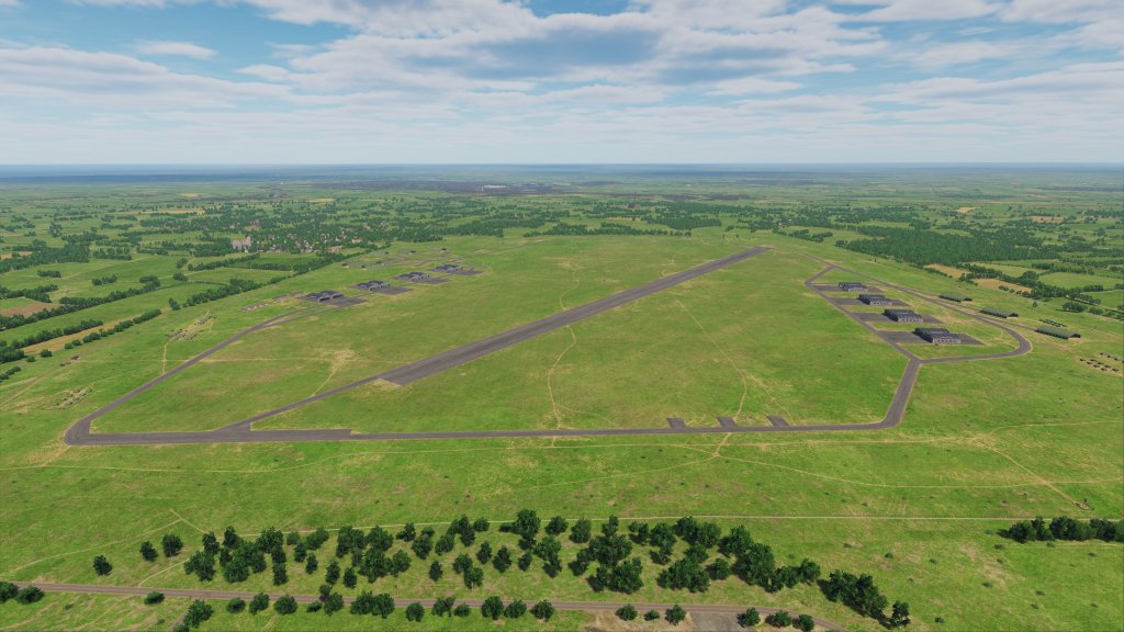
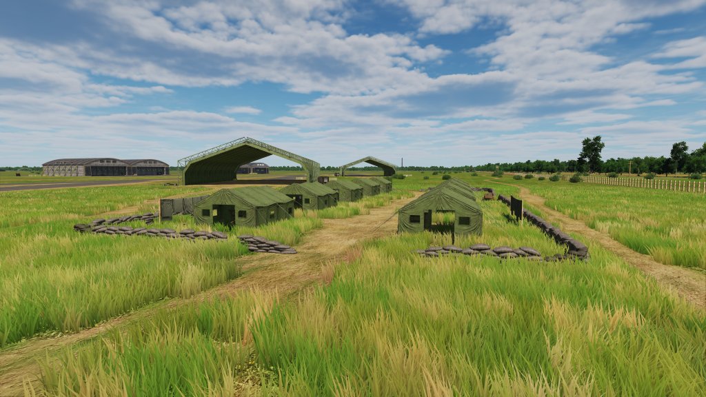
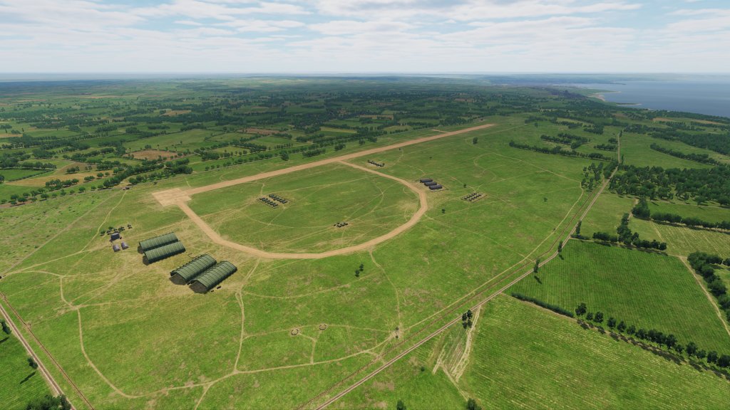
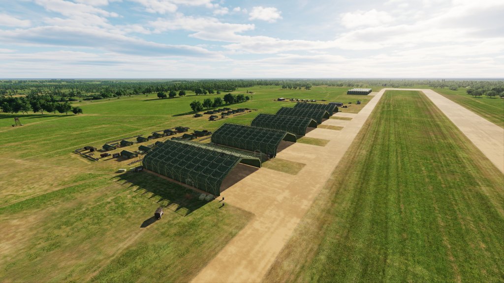
Airbases

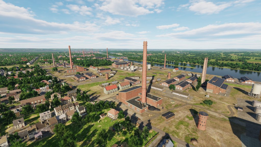
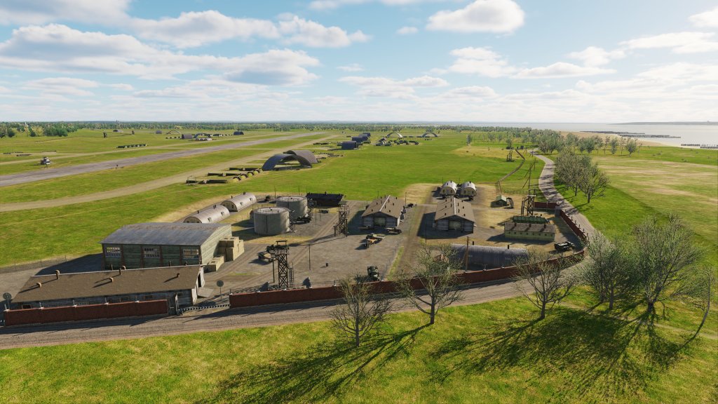
A much longer list of airbases and airfields exist or are planned for Normandy 2. Normandy itself is littered with over a dozen of temporary airfields that sprung up almost overnight following the success of the initial invasion. Tactical Allied airpower began flying from these fields just days after the June 6 invasion and most of these fields make the list. Famous fields scattered throughout the region also served as the home bases for several German squadrons.

Here is the full list of French airfields:

  • A1 Saint Pierre du Mont
  • A2 Cricqueville-en-Bessin
  • B17 Carpiquet
  • A12 Lignerolles
  • A14 Cretteville
  • A15 Maupertus
  • A16 Brucheville
  • A20 Lessay – оригинальны
  • A3 Cardonville
  • A4 Deux Jumeaux
  • A5 Chippelle
  • A7 Azeville
  • B9 Lantheuil
  • A17 Meautis
  • A21 Sainte-Laurent-sur-Mer
  • A24 Biniville
  • A6 Beuzeville
  • A8 Picauville
  • A9 Le Molay
  • B11 Longues-sur-Mer
  • B2 Bazenville
  • B3 Sainte-Croix-sur-Mer
  • B4 Beny-sur-Mer
  • B7 Rucqueville
  • B8 Sommervieu
  • Beauvais-Tille
  • Cormeilles-en-Vexin
  • Dinan-Trelivan
  • Fecamp_Benouville
  • Evreux
  • Guyancourt
  • Villacoublay
  • Saint-Andre de l Eure
  • Orly
  • Amiens_Glisy
  • Argentan
  • Avranches Le Val-Saint-Pere
  • Barville
  • Conches
  • Creil
  • Deauville
  • Essay
  • Flers
  • Goulet
  • Hauterive
  • Lonrai
  • Poix
  • Ronai
  • Rouen-Boos
  • Saint-Aubin
  • Triqueville
  • Vrigny
  • Broglie
  • Beaumont-le-Roger
  • Bernay Saint Martin

I didn’t visit all of them but you can see in these screenshots that the fields that I did visit are well represented showing off the dusty conditions in Normandy in particular as well as the varied surfaces that many of these fields possessed.

Coming soon

Eagle Dynamics has not yet said when but DCS: Normandy 2 looks to be in great shape for a release soon. As you can see from this preview and by part one, the map comes packed full of features including an expanded area that is jam packed with details.

It’s too soon to say how this map will be ultimately received, how quickly mission makers and multiplayer servers can take advantage of it, or what the plan for DCS WWII content is in the future but this map is certainly promising.

25 Comments Add yours

  1. CAP says:

    As someone that’s never owned the map I always hear people talking about it’s poor quality. My understanding is that it’s the opposite of IL-2 maps. By that I mean the IL-2 maps look great at medium-high altitudes and the DCS Normandy map looks good at low altitudes, with it worsening the higher you go. Is this accurate for this and other certain DCS maps?

    Like

    1. ShamrockOneFive says:

      The first version of Normandy by Ugra Media had a difficult history. It was Ugra’s first map, the first third party map, it needed a special DCS World 2.2 alpha package to work (separated from the DCS 1.5 and DCS 2.0 alpha also kicking around at the time).

      They did some major updates to it a few years back which really improved the map significantly but this version brings it up to the latest specifications.

      DCS maps have all had different experiences when it came to looks at low, medium and high altitudes. They sometimes use a mix of satellite imagery and textures at the same time… kind of unique.

      Like

    2. Rob says:

      The “poor quality” perception came from the following: When this map first appeared, we had just Caucasus and NTTR. Compared to these, Normandy had several issues:
      1) Higher details were popping in into the view much closer to your plane. For example hunting a train – you saw it clearly from the distance, but getting closer the trees would pop into your face in quite unpleasant way completely hiding the train. NTTR, having no trees, does not have this issue at all and in Caucasus it is definitely not so in-your-face, because the transition is much smoother and happening further away.
      2) Cartoonish green – the terrain looked too vibrant and bright.
      3) Trains were visible only when running west to east direction
      4) Higher hardware demands – more stutters were experienced on this map than on the other two.
      5) Nonexistent communication on the official forum
      6) The terrain itself is boring – not the map-maker’s mistake, the geography is just flat.

      There has been a revision of the map, which added few more details, toned down the colours a bit, the hardware moved on over the years, so it is not so bad now, especially when:
      – Marianas showed us what demanding map really looks like
      – Syria cemented their things-growning-in-front-of-your-eyes approach

      Like

      1. Chris says:

        I kind of like the green scenery.

        Like

      2. ShamrockOneFive says:

        It was previously a but too neon. Now it’s a bit more muted.

        Like

  2. While I regretted buying Normandy 1, I’ll get the update to Normandy 2. Ugra media really improved in terms of quality, as already shown in the Syria map. Very good stuff!

    Liked by 2 people

  3. CanadaOne says:

    Normandy 1 was a dog’s breakfast when released. It was crap. But they fixed it up so it’s at least decent now, but it’s still kind of boring. Normandy 2 looks tasty. The night lighting in Paris and London are my big things.

    Hopefully we’ll get a nice update todayu and maybe even a release of something. Ya gotta be hopeful. 🙂

    Like

  4. Blue 5 says:

    I am thinking of this map, but after getting a whole new high-end system, Marianas is still a total shizzle-show for me. Now wary of maps.

    Also….F-4

    Like

    1. ShamrockOneFive says:

      I haven’t tested this from a performance point of view with a big mission running on it but this seems to weigh about as much as Syria does. My system is pretty beefy these days but it never skipped a beat while I was flying or zooming around with the camera.

      MT was not enabled with the preview I was on so it could only get better.

      I suspect Ugra have really dialed in the optimization – for a DCS map. Stuff could change between now and release and I’m not a benchmarked but anecdotally this was running well. Keep an eye on it for sure!

      Like

  5. 216th_Cat says:

    The detail is really quite something; let’s hope that it doesn’t kill my poor old PC. I suspect that I’m on the edge already.
    I see that the tide is out at Mont St Michel; is that the same across the whole map? Low tide? That would be a first I think.

    Liked by 1 person

    1. ShamrockOneFive says:

      You know that’s something I hadn’t fully considered… I think it is low tide or maybe somewhere in between in some places? Visually the boundary between water and land is very well done – like what we’ve seen with Syria and Marianas.

      Like

      1. I feel the boundary water-land is appealing eye-candy, but not realistic. IRL the water is less crystal, the waves stirr up everything.

        Like

      2. ShamrockOneFive says:

        I’m sure someday they will devote some shaders to doing different types of occlusion based on local particulate counts and the like. As it is, it’s a bit of an artistic choice.

        Like

  6. Urgent Siesta says:

    Thanks again for the great review – your WWII-centric perspective is especially good.
    Another thing I realized is that a “printed” review with lots of pictures might actually be better than a video. So much easier to focus on the fine details of each shot.
    With the vids I tend to focus more on the moving objects than the map itself…

    Liked by 1 person

    1. ShamrockOneFive says:

      Many thanks! Yeah I look at this as potentially being DCS World’s definitive WWII map. I hope some content continues to fill this area out even as they start to tackle the Pacific.

      Like

  7. Picchio says:

    Okay, so: the Louvre yes, but not the 15th century church that sits just across the street… in front of its main damned entry? And the Palais-Royal is now a… park? Come on!

    Like

    1. ShamrockOneFive says:

      I’m sure there are limits to the time their artists can spend here. Would you remove other notable landmarks for those points of interest instead?

      Like

      1. Picchio says:

        Haha, I’m sure of that too. I was of course being ironic (in part)! It’s just that when I see these obvious omissions I can’t help but try to imagine the decisions behind the map’s production. I mean, couldn’t these shortcuts have been taken elsewhere, to try recreate these monumental (and well known!) sites without butchering parts of them? Not that we’re in a position to discuss it, but the logic seems questionable at best. Someone else noted, for example, the decision to include and build the Maunsell Forts but not Dover castle (even a simplified version of it)! What’s your own take?

        Like

      2. ShamrockOneFive says:

        My perspective tends to be from a overall project manager’s point of view. With X amount of dollars, Y number of things to accomplish, and Z amount of time to do it I’d make decisions on what are the most important parts that will sell and be useful.

        So…drilling down very specifically to your point, parts of Paris will be more or less generic while other parts will be the iconic landmarks. The Louvre is important but the cathedral across the street is not as important. I’d do the Louvre.

        Always a matter of tradeoffs. IMHO what I’ve seen of this map in preview (and we know they are planning to add on a bit during early access so its not the final product) is a much more thorough job versus the original and one that’s been executed extremely well.

        Like

      3. Picchio says:

        Hmm. Reasonable points but I’m not sure I agree. Perhaps both production managers and map artists should at least a little bit more versed in architectural history… so that they might better agree on what to actually make 😉

        Like

  8. Chris says:

    Le futur est le passé, le passé est le futur.

    Like

  9. Chris says:

    Looking forward to it getting released, soon?

    Like

    1. ShamrockOneFive says:

      I don’t think a date has yet been announced but judging by what I saw it’s likely to be sooner than later.

      Like

Leave a comment